A bike tour in the Alps seems to be curious because most bikers prefer flat areas for their sport. On the other hand the Alps represent one of the most imposant countryside of Europe. So let it be a challenge for a great adventure.
The bike-technology was in progress during the last years. We now have the "Mountainbike" having good brakes and gears pushing the biker uphill. (Later I found out that on normal roads a light-weight racing bike is more convenient). If one stays at a steady station and starts tours in the surrounding areas a mountainbike is more universal.
Well, we own a red coloured mountainbike of Kettler, Special Edition, this must do it.
The plan to go to the Alps has it's origin in the last year trip to Hungary: Passau - Wien - Plattensee. The Alps were often to be seen aside our route and my eyes got wide. Having 4 further members in my family - a dog in addition - you must use another trick: talk early and often of such a nonsense until everyone is used to it. Then buy roadmaps and study the route. It is funny, that you always figure out the first day. This is a certain psychological effect for you wait for nothing more than the very first day.
I didn't try to find anyone else for companionship, I told of 'nonsense' before and therefore didn't dare to ask someone for cycling in the Alps. There are several advantages in going alone: you are completely free, nobody can wish you to hell after any desaster, you can push or be lazy as you like - and so on...
Besides that you have a more intensive experience of all impressions on the tour. For I cannot share these things with any partner I made fresh daily notes and afterwards wrote down the memories to preserve them over the years.
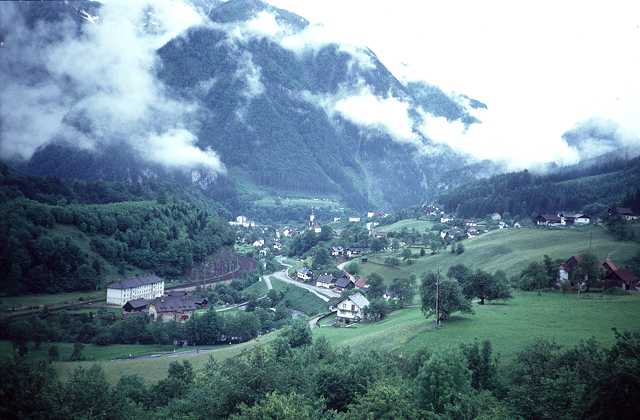
After many sunny weeks this morning a pouring rain comes down. Well I have some time yet to prepare the bike, to assemble the panniers etc. At 9 am the rain lets up and the first and nasty part begins along the big ringstreet (Margaretenguertel etc.) with too much traffic. Out of Vienna along the Voesendorfer Strasse, at it's end there begins a signed Biketrail to the south of Vienna. Unfortunately after the big rain this is somewhat wet and softened. As usual I soon miss the right direction and find myself at Traiskirchen. (In the neighbourhood there is a locality named Gumpoldskirchen, you may figure out what makes this name famous)
The nexst stations are Baden, Bad Vöslau, then there is the first hill up to Pottenstein. Nothing to be seen of the Alps, the clouds are hanging deep upon the mountains.
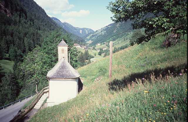
Now up a valley to Pernitz, there is a saddle with 650 m altitude. It rains again so during the descent I get pretty cold. At a bus stop I must change my clothes and warm up. I go on to Gutenstein at the Klostertal, then there is a second pass with 765 m height. Finally there is a descent 7 km long to Schwarzau im Gebirge, we have 5 pm and right away I find my accomodation at the Bacherlwirt. It is a very original inn - as you would imagine one if you dream of the Alps. So the first day, which was not only enjoyable, ends fine.
In the evening I make a final visit to the local National Park. The inhabitants of Schwarzau seem to be very proud of it.
At the next morning I pay for dinner, bed and breakfast DM 20.-
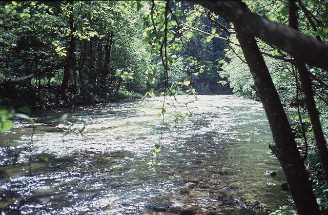
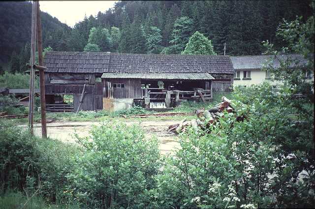 Sawmill in the Klostertal |
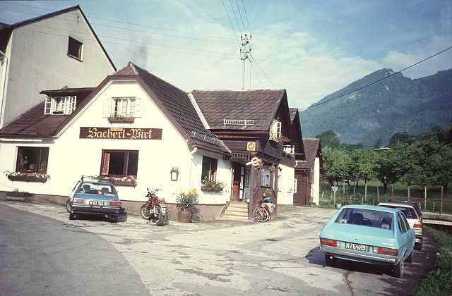 The Bacherlwirt |
Now there waits a uncertain piece of way before. The origin of this intention stems from those very first plannings I mentioned above. Dozens of times I had taken a glance to the maps if this way would work. One can save 30 km on the way to Mariazell crossing a hill named Gippel - if it would work. At the inn they told me, some crazy folks had done it, but it should be necessary to carry the bike.
At first there are no problems. The way is paved by asphalt. But then there must be crossed a valley, so the capital of height is lost again. Leaving the last houses behind (Gasthof Triebel) a steep ascent begins, the way is of rough gravel. Step by step again you can push it.
But then there is a fork: the fine way leads to nowhere and the small and much steeper way leads to Mariazell as to be read on the signpost. It's a pilgrim path to pay for sins and evil things one did in the past! So do I !!!
You can read of it on the boards nailed at the trees, offered by former pilgrims. Did they have a bike and heavy panniers like me? I can climb some minutes, then I have to stop and breathe down. One hour at all, then there is more light amongst the trees and a sweet and soft way across the saddle and a meadow. Some wooden houses are lonesome places.
The altitude of the summit is 1134 m, I am proud to have made it, the first time above the 1000 m limit.
 Boards of the pilgrims |
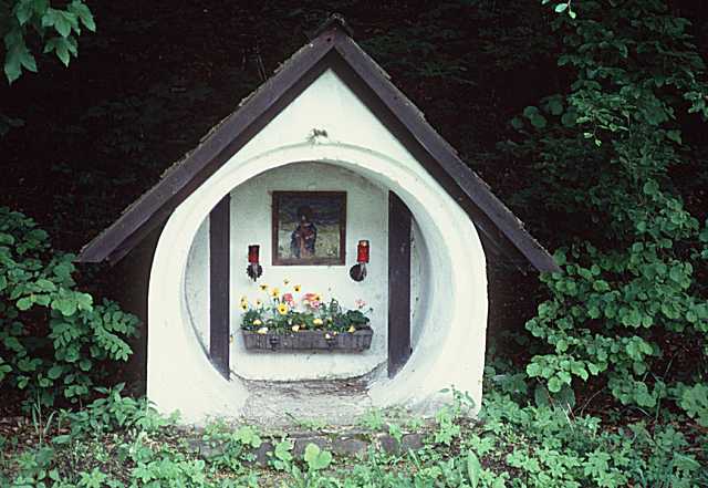 Kanalröhrenmarterl |
Now the path runs down on a comfortable forrest trail to the Lahnsattel, 1000 m. This place got it's name from a desaster during the last century, a big landslide. You can read it on a commemorative stone: 10 victims. Some racers pass by, my outfit is not theirs, so the greetings are short.
The next 15 km run down the Halltal. I have time to think of this morning and it's strain. How far will my tour go if this style will be preferred further on? But in the moment I am running fast towards Mariazell. The next sensation is waiting...
The exit of the Klostertal is blocked by the Salzaklamm (gorge). So the street winds up again to reach over the hill. But not me. I enter the gorge - my favourite pilgrim path again. "At one's own risk" is to be read at the entrance. And the place is so nice, you MUST get curious of the continuation. Besides that you can avoid the hill.
First across a bridge, then among and over rocks, up natural stairs, and suddenly I find myself 25 m vertical above the waters. Now I must carry the bike, cautiously climbing down I reach the ground again. Sweat runs down on my face and body. Now there is a signpost, it points out three directions: Klammweg that's where I come from, Klammweg that's where it's going on, and the third is Mariazell, a very steep trail up the hill I wanted to quit. But the way is wide and fine now, so I go on in the old direction.
Soon it ends. The path is winding up again in narrow hairpin turns, hard to carry the bike around the bends. 50 m higher the path continues, I must give up. What to do now? I must climb up just that hill I wanted to avoid!
 Entrance of the Salzaklamm |
 The Salzaklamm |
On the way up I must bend the upper part of my body nearly horizontally to push the bike. Stops again to breathe down. One long hour. Then there are devices of a fitness trail, so the next road cannot be so far. And so it is.
And there I find out the consequence: Mariazell is located just upon this hill. It is 1 pm. All the time before noon I have spent for just 30 km. Many tourists around here, are they all pilgrims? I buy some food and drinks and do not feel well at this crowded place.
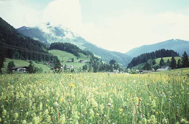
Now I head for 50 km down the valley of the Salza, my favourite. The weather is great, the landscape is a permanent delight. Many photos, water from the wells, river rafters. On the left there is the Hochschwab and his wild brothers, the characteristic mountain of this site. Here are the Alps and I can see them. Everything is in blossom, even more orchids. Not much traffic on the B24, many say hello.
 Some stuff of a painter |
 Orchid and Hochschwab |
I pass the village Wildalpen, a center for river rafting. At Palfau a romantic road leads to the Ennstal. A construction site of a high bridge represents the domination of technical power over natural structures. But this will be seen more often further on my way.
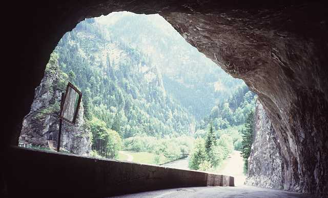 A Tunnel |
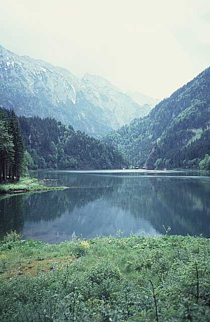 Water reservoir of the Salza |
At 7 pm I arrive at Hieflau, where the Gesaeuse begins, the canyon of the Enns. It's my destination today though not so nice with wide streets. The only inn does not look fine. So I throw a glance at the information board and find a pension outside the village. This means another 15 minutes up a hill. Voices and music are to be heard long before - seems to be something like a Disco. But I get my room, my beer and sausages in the evening.
The panorama of the balcony down to Hieflau is very picturesque. My bill the next morning is DM 25 altogether, so I am very content with this place.
 Hieflau |
Start at 8 in the morning, the weather is not as good as yesterday. The mountains are hidden by clouds and fog. Now I pass the Gesaeuse, the Enns breaks it's way between Ennstaler- and Eisenerzer-Alpen. Sometimes this is very impressive, as the wild waters rush over huge blocks of stone. At some places this wilderness is killed by a dam where the waters are used to produce electricity. Some more construction sites and a tunnel. Inside of this I loose my orientation, the lights of the bike do not work - as usual. So I follow a car as fast as I can and soon arrive at daylight again.
The upper valley is wide and friendly up to Liezen. I find a smaller road for a while but soon I reach the Bundesstrasse again with more traffic. There is the Bosrucktunnel nearby bringing my motorized friends from the north (Linz area). But the wind blows from behind from the eastern side, that doesn't bother me. In Liezen I take a rest but don't find a comfortable place, too much industry and modern buildings around. Now I have to ride on the wide racelike road up to Trautenfels. There is a remarkable sign besides the road:
Liezen - Trautenfels
The Greatest Cemetery in Austria
Now I have to speculate about this matter for a while. Why that and where is the cemetery? Another sign gives the solution:
100 killed in 10 years
I try to avoid this road as often I can and pass the villages aside. In Trautenfels there is the junction with the road up to Tauplitz and Bad Aussee. The same story: a wide road and sometimes a village with parts of the old road. I don't feel good now, a little drizzle, cold wind from ahead and the street slightly going up. The last stretch to Bad Aussee runs down again, but now it is raining and I have to change to warmer clothes, long trousers and even gloves.
At Bad Aussee time is 3 pm and I am hungry. I had no real meal since the last day except those sausages at Hieflau. There is an inn and I get a "Krautwickel" (cannot translate, somewhat like "stuffed cabbage"). The Krautwickel disappears in a few minutes.
I am regenerated. A nice section lies ahead, the Koppenpass, the famous Koppenbrueller Hoehle, and Obertraun. A jump to the Hallstaetter See. A couple, married or not, comes out of a caravan and they make a picture of me, standing on a piece of wood above the water.
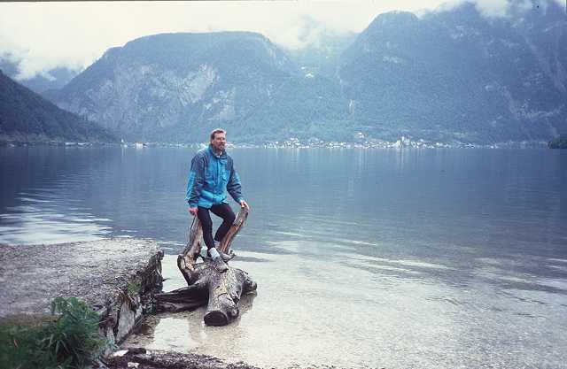 Am Hallstätter See |
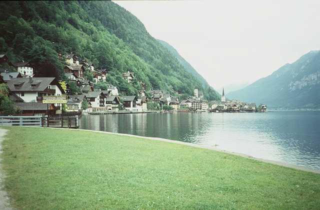
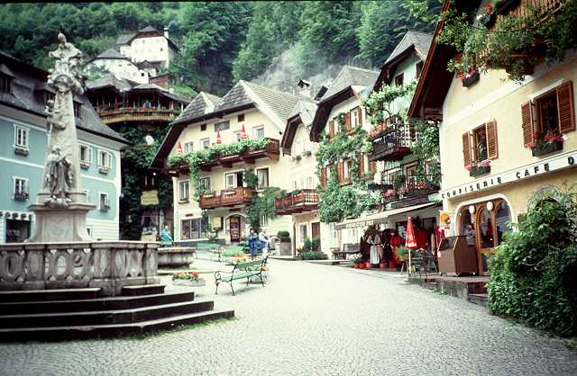
Hallstatt looks like a doll's village, everything clean and polished, flowers at the balconies, no traffic at all (that is lead beneath across a tunnel).
 |
 |
I was here 30 years ago and now have romantic feelings. In the moment there is no main season, so the location can be enjoyed more individually. The Dachstein, a famous mountain around, is hidden by clouds. The Dachstein Mammut Hoehle, one of the greatest caves in Austria, must be left on the left side above - no time!
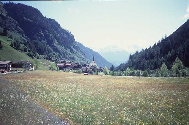
250 m way up to Gosau are waiting yet. It rains again but I am in a good state now. My accomodation is the Brandlwirt, comfortable room and a good restaurant. Some tables away some seniors celebrate the traditions of the Alps in singing those strange songs as we say "Jodeln" (no translation). I am tired and soon go to bed.
 A Meadow |
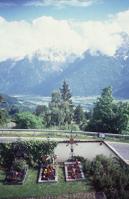
 Church of St. Veit |
I ride up the Halltal to St. Martin. But my own name doesnt't help: a strong rain breaks down and I have 20 km descent to the Salzachtal in this shower bath.
A bus stop again is the shelter for regenerating. My jacket of Gore Tex which was expensive has proved it's usefulness: no wetness inside. On the busy road I go up the Salzachtal but it will not stop raining. I must revise my plans, no Hochkoenig (the first mountain I climbed in my early days). Perhaps St. Veit instead, which lies just in front of me. It was my first holiday in the alps 30 years ago and we stayed at St Veit.
OK! That's it! Let it rain, a warm bath, some sleep, a book, a cafe, fine dinner: all things worth living. And see St. Veit again - I am highly motivated now.
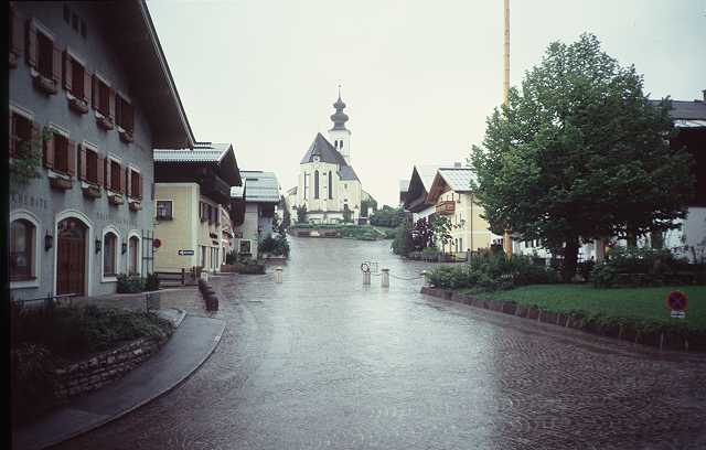
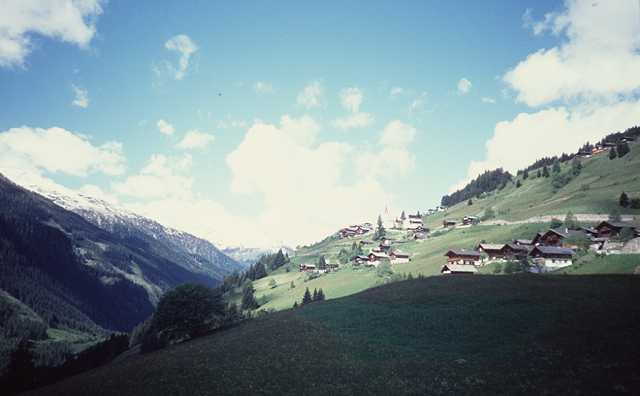
St. Veit lies 200 m up above the valley, last year they have built a wide ramp up there, not as romantic as the old winding road. At 2 pm I am there, at first a glance at the central place with it's strange church.
I feel quite at home. Asking at the first or second house I get a room at the very friendly family Freudenthaler and Haus Mariandl. And so it goes on: a shower bath, a coffee, a nap.
I ask Mrs. Freudenthaler for Leni.
She was the house daughter of the
restaurant Grafenhof where we spent our holidays.
May be I was somewhat
in love at those days with my fourteen years old...
Leni is now married to the Director of the local Bank and she is the
godmother
of the children of my family. So it is!
I go shopping but soon it gets brighter all around. What for I have a mountainbike? No panniers and luggage are needed and I find myself on an 8-10% ascent of asphalt way. It leads up to 1200 m then ends at the trail to the Schneeberg, 2000 m . The valley of the Salzach lies deep below, but the snowloaded Tauern as well as my favourite the Hochkoenig are still behind the clouds.
One hour ascent, 10 minutes descent. I would have even been faster, if there not have been such intolerant cows on the way.
My dinner is Tiroler Rumpsteak decorated by a portion of calamares (octopus). I wonder in what Tiroler waters they do find the octopus.
Another wide ramp full of traffic from Schwarzach leads up to the Gasteiner Tal, there is a long tunnel of 2 km first, but there are lights in it and a sideway gives room for a cyclist. At the end of the tunnel you find yourself at the beginning of the valley leading to the famous Bad Gastein.
But the first village is Dorfgastein. Here I was 25 years ago and made the first experiments in skiing. We had lived at the smith, the name of the family was Gstrein. Meanwhile there is a studio for arts and crafts (Kunstgewerbe). I see Mrs. Gstrein on her balcony shaking beds. I think they would not know me yet and go on.
Over a smaller road I reach Hofgastein. There are many disabled persons on the streets, for it is a health-resort in this site. One inhabitant looks with interest to my bike, he once was to the Zillertal he tells me.
The further way is nice, sometimes just aside the vivid Gasteiner Ache. The last passage up to the center of Bad Gastein is a steep road. Famous names are to be read who have made their cure here, I think about it as I read the name Bismarck. If one of those has pushed a heavily loaded bike at his arrival, clothed in sportswear?
Some sweat has run when I arrive the center. In front of the famous waterfall I lean the bike to the fence and some friendly people shoot a picture of the waterfall, the bike and me (I should have pulled down the legs of my trousers first :-).
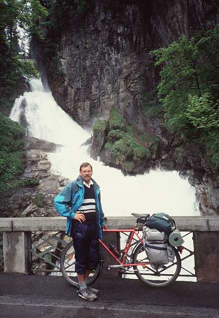 The Waterfall of Gastein |
Beside the waterfall you can find some informations. The waters fall down over 300 m and spray negative ionisated stuff in the air. That's why all the guests come to this place and breathe the air. Another reason will be the high comfort of the classic hotels, but some of these seem to have seen better times. The Casino looks good. A Rolls Royce strolls around. A parking garage doesn't fit to this scenery.
I make my way up to the railwaystation and buy the ticket for the tunnel to Mallnitz. But the next train will go not before one hour later. They tell me that there is an earlier train from Boeckstein 4 km away in 20 minutes. So I hurry up one eye on the speedometer. 5 min. before departure I arrive at the platform and jump into the train. 5 DM for 8 km and 5 minutes darkness. Then you arrive at Mallnitz on the sunny side of the Alps. And so it is, the sun is to be seen at least but erverything is dry. The wind is cold and the mountains behind the clouds as well.
The descent leads into the valley of the Moell, I must stop for a while for a slow van blocks my way. But at more than 60 km/h tears in the eyes make it impossible to run faster. The next 30 km up the valley of the Moell to Winklern. The route of the Glockner joins at this place. Well, there I am anyway.
Before I start for the Iselspass I enter a petrol station and put some oil on the chain out of an old can. Now up to th 1204 m height of the summit. I can ride it without pushing the bike. Something new! On the top there is beautiful sunshine, the Lienzer Dolomiten in front steam from the fog. The best place to watch this scenery is the Iselsbergkapelle.
 At the Iselsbergkapelle |
 The Isel near Huben |
Down 500 m to Lienz at the Drau. Much traffic in the town and on the road to the Felbertauerntunnel. I cannot avoid this part to reach the Defereggental. Soon I find a nice way aside the bank of the Isel leading 10 km to St. Johann im Walde. Only some cows bother me but I stay alive.
At St. Johann there are exactly 4 houses. The first pension is booked up by Italian fishermen who catch trout in the Isel. At the second house the woman is very kind to me and offers a room beneath the roof which is not completely furnished. But I don't care and am glad to have a home for this night.
The best is the meal for dinner: Pasta Chiuta and a huge portion of salad. One beer in addition and I feel like a balloon. So a walk does help, I even find a telephone to call at home. Finally I have a nice dialog with my host woman as I write down the impressions of the day (it's not as nice in English as it is in Tyrolian): "Oh I think you are a teacher?". I explain my work at the university at the computer center. "Oh then you are a teacher anyway!". Her husband looks something strange, may be I exterminated all his food stuff for this evening.
A steep way at first, but below there is the pretty gorge of the Schwarzach, so one should walk to look around (so do I). Everything looks like a picture-book. I climb up 200 m to St. Veit im Defereggental - one hour for this part. May be I should have stayed on the main road, anyway it is training. I buy a road map and some food, then down again to the valley.
 |
 |
 |
|
|
The highest pass until now is waiting: the Staller Sattel, 2052 m. Soon a biker passes me, he has a tiny backsack and a racingbike. He has made the Glockner pass the last day, but says it was dangerous with ice and fog. No mountains were to be seen. Comparing our equipment I feel like a trucker with my heavy stuff. Then he goes on and soon disappears around the next bench. Above the tree line you reach a rough area, the snow has just melt away.
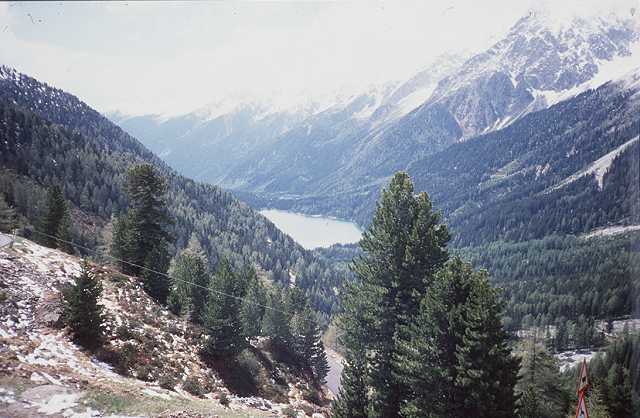 Staller Sattel |
Two motorcyclists from Duesseldorf who had passed me before, come back from the pass. I wonder if there is something wrong. At the summit for your clarity you can read, that on the road down the other side trucks, caravans and motorcycles are not allowed. The other thing is to wait half an hour to pass the frontier to Italy. Are the officers making a nap or what? The reason is, the road can be passed in one direction only and so they open it ervery hour. I have to bear a heavy shower of snow behind a stone. The thunder of avalanches sound from the walls around.
The officers have no interest in me or my passport so I enter Italia. The descent is very narrow in fact, you can hardly make more than 20 km/h around the curves. No traffic from the front so you can use all of the street. Down 600 m I reach a lake and the Antholzer Tal. The wind blows from behind and the street goes down, that's fun. 20 km to the Pustertal, but now dark clouds are threatening.
I enter a bank to change Lira. The officer feels sorry for me having bad weather all the time. So I feel myself and go on towards Toblach. I make a rest on a meadow and do not feel well. What is the sense of all this, rain and nothing of the Dolomiten around? But the show must go on, I enter Sexten just in time with the rain. The tourist office is open, I can look for a pension and prefer the neighbourhood of the church. Everything OK again, I order for two nights to make a rest at the next day. The weather forecast for the weekend is better. I have a good bath and dinner, so the world seems to be more friendly again.