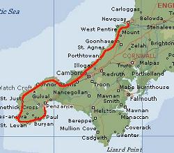
Chapter 1: Cornwall, Devon and Exmoor
| 1. Day, Saturday, Penzance - Land's End -
Newquay,
8.30-18.30, 115 km trp, 14.0 km/h avg., 53 km/h max, 115 km total |
|
Breakfast is served in an elegant hall where a copy of the death mask of Admiral Horatio Nelson is exposed. May be he once stayed in this house? Further I speak to an elder couple who are just going out for a holiday at the Scilly Islands without fear to have any boring times there. Occasionally I must find out, where the Scilly Islands are located... (30 km south west of Land's End). I enjoy the first full English breakfast with fried eggs, bacon, sausages, beans and tomatoes. This will hold to the early afternoon.
Now the memorable moment has come: the start for a tour accompanied by many question marks, for no one can say if weather, wind, breakdowns, health etc. will cause a happy end. So the begin is to push the bike from down the coast up the B3315 to the higher plateau.
Remark: Occasionally the roadnumbers are given to ease the reconstruction of the route at the road map.
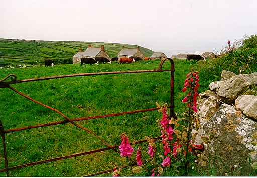
While walking up one can admire the rich vegetation. There is a humid and mild climate around here caused by the gulf stream. Along the road there are the hedges or stone walls overgrown by bushes and flowers. The foxglove blooms where ever you look.
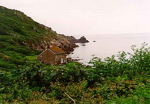 Lamorna Cove |
So I return to "up above at the road", find a sign to "Merry Maiden", see an upright rock behind a hedge and after the next curve figure out, that this was the place I was looking for. May be it is more interesting than that what I saw. Now there is a 17% downhill leading just as steep uphill on the other side of the crossing valley. We will be known to this topography soon... We enter the A30 and roll down to Land's End.
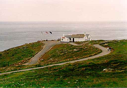 Land's End |
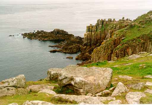 Cliffs at Land's End |
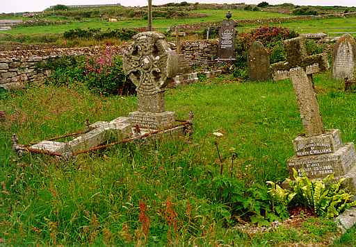 Old Graveyard |
 Former Tin Mine |
|
 |
|
 |
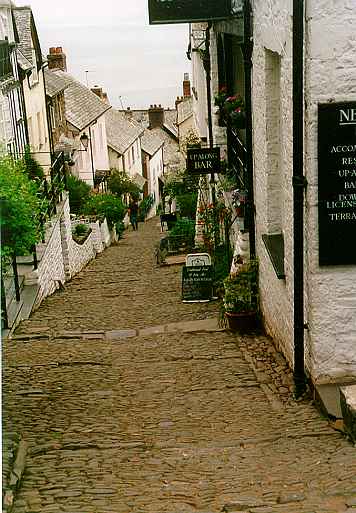
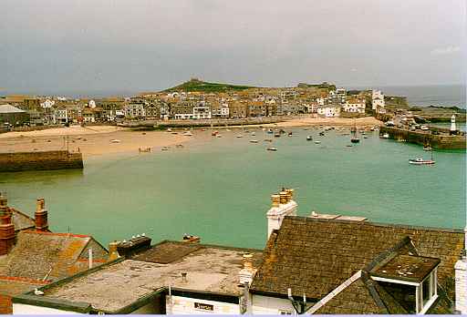 St. Ives |
 Art Decor |
The next larger touristic town is St. Ives. You must surround the mouth of a river and then reach the side road B3301. Now watch on parking cars, for there may be something to be seen. So I find a sign point to have a view on the high and steep cliffs. At secure place Seagulls and Cormorans have their nests. A couple comes along and they say "Isn'it beautiful?" and I think "It is, this is the place, where they kill their lovers in the movies". Some time later I lie on my belly and look down to the rocks and the sea 100 m below. As it starts to prickle I cautiously crawl back to my bike.

|

|
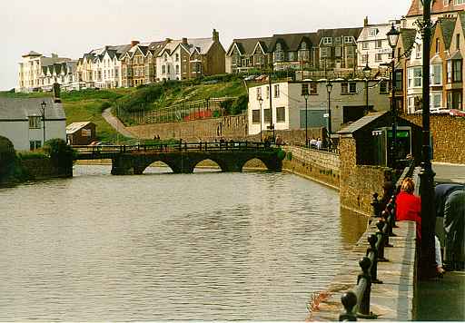
The destination for today is the greater spa town Newquay. There is a nice view from above down to the sun flooded harbour. Beside a bench there is a sign: "Alcohol Free Area". This is to prevent that thursty individuals choose this place for their parties. As I have shot my photo a guy at the bench offers to sell a film, "Cheap" he says. But I have enough yet and so the guy leans to the shield "Alcohol Free Area", opens the next can of beer and continues to talk with himself.
I look for an accomodation and ask at the Hotel St. Andrews. "You are welcome" - the nicest words on earth. Two women here sit at the bar and some pictures of kissing people lie on the table. I become curious and I think "May be I am wrong here". But before I say something wrong it turns to be a mistake on my part and some time later I happily sit in my room for tonight.
On a Saturday when the sun was shining this town is cooking in the evening. The girls run around half naked and seem to be unafraid of both: cold chills or hot boys. I do hard to find a proper restaurant but end in an Indian's. It's loud there as well but the dinner is fine.
|

|
|
|
|
| 2. Day, Sunday, Newquay - Wadebridge - Bude -
Clovelly
9.30-19.00, 122 km trp, 14.8 km/h avg., 56.6 km/h max, 237 km total |
|
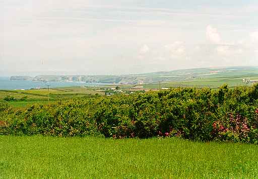
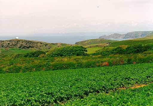
During the night some seagulls nearby must have a permanent dispute and from time to time they escalate in shrill cries. Definitely better than the noise of vans and motor traffic. Breakfast is at 9 am because we have Sunday. After checkout I continue to stay at the coast - this works as long as one gets tired to cross one valley after the other. The cliffs are rarely to be seen, this is due to the coast hikers, free from giddiness.
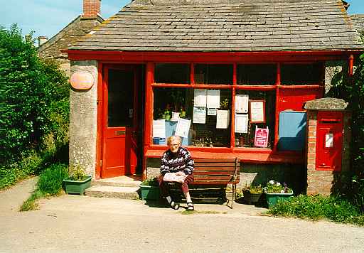
 After some time I leave the coast and look for some side roads to pass
some sleepy villages. A woman on a bench in front of a post office is a
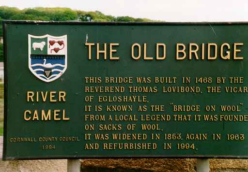
nice motive. You then reach Wadebridge and hit the Camel Trail. This is
a former railway track and used as a hike and bike path today from
Bodmin
to Padstow. The river Camel is crossed on an old bridge, a sign tells
more
about it.
After some time I leave the coast and look for some side roads to pass
some sleepy villages. A woman on a bench in front of a post office is a
nice motive. You then reach Wadebridge and hit the Camel Trail. This is
a former railway track and used as a hike and bike path today from
Bodmin
to Padstow. The river Camel is crossed on an old bridge, a sign tells
more
about it.
|
 |
 View of the Gral's Castle |
 Old Post at Tintagel(14. cent.) |
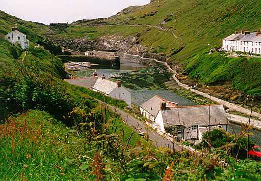 Port near Boscastle |
 The Town Bude |
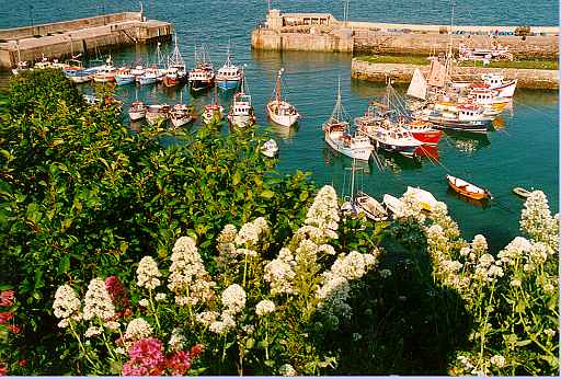
 Clovelly |
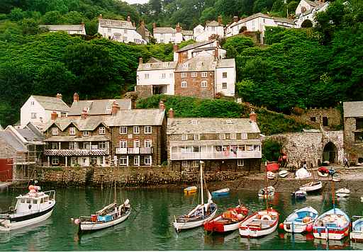 Harbour |
Meanwhile I sit in the bar and do hard with a rumpsteak made of leather. Queen: "The Show must go on..." is to be heard from the speakers. A black Guinnes, but thereafter I am very curious to explore this peculiar place. We gallop down the road/track/stairs to the fisher's harbour, the sunset at the sea and the complete silence are very impressive. The coast shows green steep slopes, at some places a landslide has come down. The only place to settle here is the narrow valley, where the houses are glued to the slopes like the nests of swallows. I think of the dream of Shangrila - a place to retire and rest. But I think of stormy winter nights too and the hard life of the inhabitants in former times. Today the tourism is the source of secure income (and if you think, there is no traffic: behind the hotel at the harbour side there is a car park, and a ramp leads up the slope...).
It is nearly dark when I return to my lodging. I think I am happy tonight.
| 3. Day, Monday, Clovelly - Barnstaple - Exmoor
- Bridgwater
9.00-18.45, 132 km trp, 15.4 km/h avg., 62.4 km/h max, 369 km total |
|
The day starts with a work, which is usually made by donkeys here. But it's up to me to push the bike up the hill to the parking site. After breakfast and check out I carry the luggage up there, pack the panniers and then have to walk uphill for another 15 minutes before the tour can really start on the A39.
We reach Bideford where the Torridge River is crossed by an old bridge. The next few miles we can use another former railtrack named "Tarka Trail". Every cyclist knows, this is riding of it's best - no hills, no traffic. And nice views to the wide mouth of the river all the time. What a pity, at Barnstaple the trail ends. I now head to Exmoor, and this means going uphill for a while, but not as steep as near the coast before.
We finally leave the A39 and enter the B3358. The landscape is not so remarkable: hedges, meadows, sheep. At damp places the rush and cotton grass (wollgras) grow and holes of black water glance from below. Somewhere there is an old church surrounded by stone walls and rhododendron. The road leads down to the village Exford.
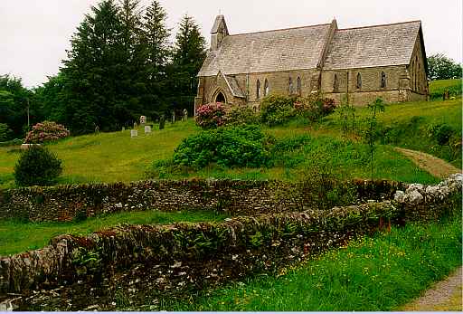 Church near Exford |
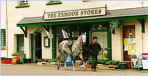 A Horse comes from Shopping |
From Exford we run down through a valley with woods and reach a touristic town named Dunster. Ther is a castle, a cathedral and may be a monastery - a camping site as well. In the afternoon I reach the coast again and join to my "favourite" A39 now with much traffic. Now they have built up some last hills named Quantock Hills at the very end of the Cornwall and Devon peninsula. Another local cyclist behind me calls out when he passes: "Hard Work up this hill!". I think I called back "Really!".
The rest to Bridgwater is plane and they have traffic lights for to drive the cattle. At the moment there is no use of it. Arrived at Bridgwater I ask a passenger who signs to the "Blake Arms Hotel" nearby. The only problem there: where to put the bike? After some crawls behind his ear the barkeeper remembers the backyard where I lock the bike to the pipe of a gutter.
I end at an Indian Restaurant, make a walk afterwards but
cannot find
much interesting. Some time later back in my room I listen to a concert
of a crying no-lady eagerly using the famous English word beginning
with
"F". At 10.30 pm everything is quiet, this is a law.
