Eupen Eupen Kirchenkreuz Eupen-Panorama | |||||
1. Day: Th, 3.6. Aachen – Kronenburg, 85 km
My train gets off about 7 am, train change at Dortmund and
at 12.07 we arrive at Aachen. Just behind the railway station there is
the
road towards Eupen/Belgium. Aside the road there is a cycle path
leading slightly uphill. Then there is the border to Belgium. Since the
Schengen Agreement there are no more border controls at all. Just a few
booths selling fruits or vegetables or so.
At Eupen there is a busy traffic, I have a rest and some photo-shots.
"Do you like to occupy this place?" a woman asks me because I have
placed
my bike behind her car. "I run off at once" I say. The region of
Eupen-Malmedy has a changeful history. They were thrown between the
German and Belgium nationalty for several times. Now it seems they all
speak German, moreover in Colognian slang.
I resign to go to Malmedy, may be I reach my destination at the river
Kyll today. But now we must cross the "Hohes Venn" and this is easy
climbing for one hour. There are upland moors and vast nature
reservation areas. Today it is too hazy to have far sights. At the
tower of the Signal de Botrange
there is the summit at about 600 m
height. From now on we run downhill and finally find smaller roads back
to the German border at the Losheimer Graben. And I have the wind from
behind all the time and this will be the same for the next days.
Somewhere on the route Sawmill Kronenburg Wilhelm-Tell-Gasse |
So we soon reach the Lake of Kronenburg and the destination. But it is
surprising, that the town of Kronenburg is on the top of a hill.
"Medieval town center" is to be read, so I push my loaden bike up
there. The town center is a single street or two with nice old houses.
I cannot get a room at a private pension, they don't like
one-night-guests as they say. A "Zimmer-Frei"-woman declares: "The room
is to be made anyway" after she has fibbed that there is no free room
in her house. So I end at the Hotel Eifelhouse around the corner. I get
a room with an outlook over the valley but not so cheap. The bike is
locked at an old town gate named Wilhelm-Tell-Gasse. At the hotel there
is a young dog (Retriever-Labrador) named Anton. He tries to bite in my
pants while looking for a game partner. So I must say: "Please stop that
my dear, I only have these single pants".
In the evening I get aspic a la
maison with fried potatoes and salad. This is enough to refill
the tank for the bike. A final walk and I find a board with
informations about the Jakob's-Path.
Then there is a path up to the
ruins of the former fortification. There are only the remains of some
walls and the half of a tower. The rest of the evening I sit at the
open window enjoying the
outlook
and the baa of the sheep until it gets
dark.
2. Day: Fr, 4.6. Kronenburg - Trier, 115 km
Today we will ride the Kyllroute, length about 100 km. The river Kyll
is rather unknown, as well the bike route which was built in 1993. So
it is an insider's tip."At both sides of the route there are mills,
castles, churches, chateaus, museums and picturesque villages of the
Eifel" - so it is to be read. And a twisted railway winds its way
through the valley
(therefore some weeks later my norwegian friends
Turid and Terje
will come along here).
Kyll-Radweg im Regen Die erste Kuh ist noch aus Stroh Tunnel auch für Radfahrer |
Not so nice is the rain today. When I start I think "It gets brighter already" but this was an error because it keeps raining into the early afternoon. But as the wind comes from behind (north) this is not such a bad thing. There is often a slight downhill because we come from 500 m down to 130 m at Trier. The bad thing is: everything is grey and foggy clouds hang above the meadows and hills. So we have a brand new camera but no colours at all. Our main companions today are the grapevine snails. They have a moderate speed and so no collisions occur. We pass the mineral-water-town Gerolstein and castles like Bertradaburg or Ramstein and so on.
Pdr_0221 Regenbilder Pdr_0224 Pdr_0223 |
There are two passages through railway tunnels, where the cyclist finds
a seperated lighted track. This is absolutely extraordianary. In the
late afternoon we reach the river Moselle and near Trier industrial
areas. Finally we come into the pedestrian area of Trier along the
Moselle-bike-path. But I have forgotten to give a hint to a nice little
place before Trier named Pfalzel.
This is very scenic with half timbered houses, flowers, a cloister and
nice restaurants. May be one finds a nice accommodation there.
But meanwhile I stray around in Trier. There is a hotel with a Bett
& Bike sign but everything is closed. So I find the Hotel Aulmann at a central place.
And the Restaurant Peking is
around the corner - if you know me better you will await what happens.
I have a small talk with the chinese service maid to get a draught
beer. But she doesn't understand me, so let us have a Bitburger or so
from the bottle. But the meal is exquisite: pork sweet-and-sour and a
heap of rice. There is no granule left.
At the final walk we soon stumble across the Porta Nigra. Of course you
must perform a walk-through like the good old Romans did. We have the
Dome
and the place at the townhall, but then we have leisure time. In the
television I find a report about some crazy adventurers who had spent
years of their life and lots of money to break the sound barrier by
a rocket-like wheel-vehicle. I will not have such ambitions...
3. Day: Sa, 5.6 Trier - Sarreguimines, 135 km
At first we have a grey day again but later on it will be better. The
wind will not change and this is a fine thing. We will continue at the
river Saar and now need the bikeline-guide. I don't like to buy all the
brochures of a tour in advance for we then have a certain amount of
weight which is useless. In the morning the book shops are still
closed. So I start "blind". But the fine signs of the
Moselle-bike-trail and since Konz where the Saar comes in the
Saar-cycle-track avoid to get lost.
Saar-Radweg bei Konz Saarburg |
Mostly the track leads along the
river on traffic free tarmac surface. Around Kanzern you can choose
from a fork: one route is short and leads along a canal straight ahead.
The other branch leads around a slope of the river. This is the more
scenic of course.
We come to Saarburg, a nice
town. Let us enter the centrum to find a book-store there. There is one
and they can sell the bikeline-brochure, so I am complete now. The main
attraction of this town is a waterfall and some mill-wheels down at the
river. It will be difficult to stitch the four photos to a single one,
so until now look at the origins.
Furtheron we follow the green loops and slopes of the Saar. After the
town of
Mettlach we await the famous 180 deg. loop. High above of the turnpoint
of the loop
there is a restaurant with an outlook named Cloef - unreachable with the
bike. So I have taken a photo from
the Net, let us hope that no one will complain about this.
The valley now gets wide and the woods and slopes give way. At
Saarlouis I leave the bike trail to reach the center and a super
market. There is much trouble because they have a festival today and no
motorized traffic is allowed. But the cyclist has no problems. As I
leave the market I find a tick on my panniers. These are dangerous and
can transmit a certain desease (Borreliose). But this was the
only meeting with one of those beasts on the tour.
Pdr_0236 Pdr_0238 Industrielandschaft |
I am pretty fast today caused by the good wind. This is adequate
because the landscape turns to be more and more industrial.
Near the Völklinger Hütte (Saar Stahl) it nearly
gets aesthetic. I observe two pit winding towers, where they mine the
expensive and highly subsidised Saar-coals.
At a village named Zettin the canal path ends or the continuation sign was
stolen? After a short stretch on the road we reach the village
Wittring. I succeed to cross a provisional bridge and then crawl along
a muddy tunnel under the dam. Funny!
The path thereafter is bumpy but after some time it gets better. The
name of the canal is Canal Houlières
de la Sarre. At some place this canal turns inland into the wrong
direction. If you don't be careful - and so am I - you must come back
after some time, when you realize your mistake. So we reach Sarre-Union at noon. Fine if there were a restaurant
to enjoy any meal. But I cannot find something and run away from some
motor-cyclists in leather suits occupying the only cafe at the place.
Some time later we push up a steep hill. On the top
there is a forester's lodge or something like that named Maison Forestière de Bischtroff.
We arrive there somewhat sweaty. Thereafter we enjoy a slight downhill
which is worth the efforts from before. On the opposite side of the
valley there is a picturesque village named Wolfskirchen. This village is up
above at the slope and so it is to be seen from everywhere.
And what do you think - yes, you are right: there is another festival
here. So the tourist information bureau has open on Sunday. They phone
to the next hotel around the corner and this is Hotel-Restaurant Du Soleil Levant.
This is a Vietnamese one and the food is Asian and I don't bother...
Before I may have a look into the Chapelle
de Cordeliers, cost-free today as on every first sunday of the
month. There is a famous glass-window created by Marc Chagall. This is
prized as a monumental work of art named "La Paix". Somewhat like Adam and
Eve surrounded by red flowers with a blue background. At the museum
there is a gobelin of Chagall as well but this chapel was enough for me.
The hotel is behind the nearby church and I get a nice room. I then
cycle to the railway station to get a road map of the Vosges area. I
succeed and purchase a Michelin road map, so the further plannings can
go on. For dinner I get a spring roll and Porc Grillè and Riz
Nature. But tomorrow there will be no breakfast because they have their
rest day on monday. So I pay my bill and can start as early as I will
in the morning.
We then reach Saarbrücken.
This should have been the final point
for today. Sometimes I don't like places. This time this is caused by
another town-festival (Family's Celebration or so). Moreover there are
lots of crying soccer-fans carrying banners of their soccerclub 1. FC
Saarbrücken. Did they win? I ask a boy at the side of the street.
Saarbrücken has won 2:1 against Schweinfurt and now ascends to the
second German soccer league. This is not my theme.
I continue awaiting the next occasion for an accommodation. There is a
fine path along the river and soon we cross the border to France and
end at Sarreguimines. I ask a gentleman
to find a hotel and
end at the Hotel Aux Deux Etoiles with a
simple room and no breakfast. To pay in cash, they only accept French
credit cards. But this was the only place in our common Europe. The
monsieur demands me, not to stick the key of the door from inside of
the chamber. May be if there is a fire or so? But I soon check out,
that I can balance out of my window in the second floor down to the
street in the case of an accident. This is academic
gobbledegook. But on the
street under the room there is a busy traffic, so we will not have a
silent dawn hour.
I look for a pizzeria but cannot find any satisfiable. But the Restaurant Shanghai, guess that I cannot deny to stay
there. Then I am very disappointed about the meal and the mass (rice
costs extra) and still am hungry. I find out, that the other guests
order one meal after the other, so they surely will have enough. But
you must ask your wallet as well. I still have some yoghurts and a
spoon which jumped into my front bag at the breakfast-buffet last
morning.
During the night I must keep the windows shut because it is too noisy.
Remelfing
Sarreinsmig
Sarreinsmig
I must start with an empty stomache. I still have some chocolate. Today
we have Sunday and the shops are closed except fuel stations but those
are not to be found in the botany. But we have the best weather:
"Kaiserwetter" as we say in German. Now we detect picturesque scenes, a
mill-wheel or nice villages now and then.
The track leads along the canal of the Saar with ancient sluices
sometimes. The French cyclists hurry along in lycra dresses on high
tech bikes. Where do they go all the time? But they all say hello or
salut or bonjour or something like that.
PDR243-244
DSC018-020
Wittring (Tunnel left)
Pdr_0245
Pdr_0246
Sarralbe
At the next village I sit on a bench but immediately a guy comes up to
scounge a cigarette or so. I throw my chocolate into the front bag and
hurry on, up a mountain. And there is nice meadow with fruit-trees and
I find my place in the shadow of an apple-tree. The chocolate is rather
soft meanwhile.
Sarre-Union
Wolfskirchen
Pdr_0253
I arrive at the village Diedendorf and
get lost down a steep road. Though I had had the occasion to study the
map throughly during a former rest at the church. So back and up the
same way, thereafter we reach the village or town
Fénétrange. There are some old walls like a
town gate or
the inner courtyard of a chateau or something like that. For the rest
of the route today we choose the shorter fork across the Herrenwald. At the top there is a
beautiful view above Sarrebourg,
the end point of the Sarre-Bike-Path (the end for me - in the brochure
it is the start).
Chapelle des Cordeliers
La Paix von Chagall
Hotel Du Soleil Levant
I start before sunrise (6.00 am), it is still pretty cold. The mist
and fogs of the early morning waft over the meadows but the sky is
clear. The stage of the Vosges part will start today and I see the
mountains in front. We will have to climb, this is sure. After the
village Abreschviller the
uphill begins and will end at the summit named Col du Donon (1009 m). Most of the
road is in the woods and this is not so interesting. As we nearly have
reached the summit the great surprise comes up. Aside the road there is
an unspectacular little crater covered by grass and
moss. And a sign breaks the secret: this is the source of the Sarre. So
I had made my way from the end until this first point of birth of this
river.
Abreschviller Saarquelle Pdr_0261 |
The downhill on the other side of the Col is fine for there is few traffic and the lanes are wide. My limit is 60 km/h. The race riders are faster, I know, but they have no luggage on their bikes. We come down to Schirmeck (380 m). Now there is only the main road and we have our trouble with the roaring vans. After some time I flee into the backyard of a church or a Kindergarten or both and now study the map thoroughly. And I really have overseen the small Col de Fouchy leading towards Ste Marie aux Mines, where the famous Route des Cretes starts. This route was built after the WWI (World War One) by the French military to defend the Vosges mountains agaist the barbarians from the east. It rises to 1000 m height and then stays at this height for about 60 km. At weekends with fine weather it is the eldorado of motor cyclists. The weather is fine as well but we have no weekend.
Destille-Apparat Villè Villè |
Villé |
At the Col de Fouchy we have
to push the bike for a while and so sometimes stop and enjoy the views.
Once a snake crosses the street in front of me. It is longer than one
meter but it disappears in the grass before I can recognize her
characteristics. Be lucky that just now there was no automobile or
motor-bike coming along. So eventually we reach the summit and then
descend into the Val d' Argent.
At Ste Marie aux Mines I try to find a hotel. There is one but
everything is deserted - may be it is too early in the afternoon. There
is another hotel up the valley, a well known start point for the Route
des Cretes. Let us sweat for another while - we have 27 deg. now. At
last we
come to the last bend and there it is: Les Bagenelles, "Tour-Riders are
Welcome". I am only a pedal-biker but the money that I pay (45 €) is
the same. Now this is a wonderful place surrounded by the mountains.
The only noise are the sounds of the cow-bells and this is music that I
will hear during the most parts of the further tour.
Pdr_0275 Hotel Les Bagenelles Pdr_0277 |
After so much sweat today I make a laundry and hang the clothes on a
sunny fence outside. There comes a snoopy donkey along and sniffs at my
bike shirt (fire red and purchased on my Tour de France in 1995). So I
take my clothes and bring them to another place. May be the
donkey would
like to wear such a proper bike-shirt himself? The donkey appearantly
has a female companion because they often like to spoon with each
other. Moreover there are geese and aside a lucky pig in it's muddy
pigsty.
At dinner I have porkmedaillons and housemade "Spätzle" (something
like noodles). During the late evening finally there are more than 10
motor bikes in the stable and my poor little bike is nearly crushed.
6. Day, Th 8.6. Ste. Marie aux Mines
- Altkirch, 135 km
I have finished my breakfast when the sleepy motor cyclists blink into
the sunny morning. They will have their breakfast outside and let us
hope that their butter will not melt. So we have "Kaiserwetter" and
tailwind today - a highlight of the tour ahead!
The climb from below... ...and from above |
At first we have to climb 600 m to reach the legendary Route des Cretes. This takes about 2 hours until the Col des Bagenelles, 911 m. There we have a magnificent view above the blue ridges of the Vosges. We will ride the next 60 km at the height of about 1200 m. Of course much up and down but never for a longer distance. The key-points are named Col de la Schlucht, 1131m, or The Markstein, 1192 m. As well these places are the most nasty stations because there are wide parking places with busses and hordes of bus-tourists who hasten to the next toilets or restaurants or both.
Pdr_0285 Pdr_0286 Pdr_0288 Pdr_0290 Pdr_0291 Pdr_0300 |
From a bicycle you will see, smell and hear more: the wild pansies at the side of the road, the tree tops with moss, the sound of the birds and cows and crickets. The direction of the views is mainly west and the cause for this is the strategic fact, that the route should be hidden from the east. At last we have to climb up to the Grand Ballon, 1324 m, and this is the highest point of the day. Up there are parking places and much touristic activities as well.
PDR303-309 |
We run down unwillingly because the Vosges-tour soon will be over. Above Uffholz, where the road ends, we pass the Hartmannsvillerkopf and a memorial. During four years of WW1 this hill of strategic importance was the place of bloody battles and about 60.000 soldiers of France and the same number of Germans were killed. Unbelievable, but see the war cemetery at Cernay or other places with the innumerable rows of grave-crosses.
Pdr_0302 Gedenkstätte Hartmannswillerkopf Soldatenfriedhof Cernay |
At Cernay we have reached the plane of the Rhine and the temperature is like in an oven: we have about 34 deg. The other problem is to find out of Cernay. I pass a dusty gravel factory or so and then end at the driveway of a busy motorway. For I won't go to Paris nor to Marseille I must turn and ride back the dusty road. Eventually I find some side roads to approach the town of Basel. But today I only reach the town of Altkirch. Above the mountains of the Vosges meanwhile there are strange towers of clouds, it looks like columns of steam coming from a volcano or bush-fires. May be we have a thunderstorm tonight?
Clouds above the Vosges |
So I look for a
hotel at Altkirch. The only one is closed. I ask a baker in front of
his shop. "A hotel would be nice, but there are no employees" he says.
So some km ahead there finally is a hotel at Wittersdorf. The chief leads me to
a poor room, but as usual I am very happy to have any home. There is
only a remote skylight window with a noisy aggregate behind it. But
then I detect a swimming-pool down in the garden and soon I am in there
and enjoy the refreshment after a hard day.
The dinner comes out of the bags, the restaurant is too expensive. I am
very happy as the aggregate falls in silence at about 10 pm. But at the
next morning I will be annoyed that they charge 50.- € for this
despicable hole of a room. And the breakfast is not so good as well...
(The French serve a Petit dejeuner
and it seems the Petit is the
main thing of it...).
7. Day, We 9.6. Altkirch - Basel - St.
Ursannes, 105 km
I must go to Basel to get the first brochure of the "Veloland Schweiz".
During the last few years they have managed to generate a grid of 9
long-way cycle-tours, to sign them, to document them by fine brochures
and to sponser them. Of course those trails are more sportive than in
Denmark or Holland, which are fine countries for cyclists as well. And
Germany of course with fine river-routes. People have recognised, that
the cycle-tourism may be an important fact in local economy. And if I
look into my wallet one can see, that is not so cheap to go this way.
May be it is a question of age: you like it more comfortable at some
time. The cheaper solutions are a tent and camp-grounds, youth hostels,
private pensions or cites and self made food. May be all the money you
throw out will be kept off of an medical institute, which you are
forced to consult caused by a lack of motion or another disease.
Pdr_0315 Pdr_0316 Pdr_0317 |
At Basel begin resp. end three routes: Jura-Route(7),
Rhine-Route(2) and North-South-Route(3). I want to ride the
Jura-Route. So I only have to buy the guide for it. After 30 km
this morning I arrive at Basel, just at the
Spalentor, and the last
time I was here is more than 40 years ago. Aside this towngate is
a book shop. The owner has never heard of any "Veloland Schweiz". May
be he has learnt something by my demand. I should go to the
middle-bridge, there would be the information center. So I do, but
cannot find the information. But a good bookstore to finally purchase
the guide to veloroute 7. And that I do not behave like a philistine
(Kulturbanause) I find may way to the market place and the townhall
with it's inner yard and the
wall paintings.
But then we must continue.
The veloroute is signed from the town center at the Rhinebridges. They
have managed to find a way nearly traffic-free out of the town,
sometimes along a rail-track. But then there seems to be the end of school
somewhere and I find myself amidst of a cycling group of kids. It is
just a steep uphill and I won't give up. May be I missed a fork by this
challenge and finally are in unknown areas (Biel and Benken). Turning towards the
mountains of the Jura I soon find the signs of the route again. So
I have a rest on a meadow near Mariastein.
This should be a place of pilgrimage but it is up on a hill. So I stay
to my meadow, and thereafter have to climb anyway. We reach the nice
village Metzelern, where cheering kids have a bath in the
fountain-basin of the village ("Eaux non potable" - no drinking water).
I would like to do the same. To get something drinkable I enter a pub
and go to the toilet. I get some water, but it is difficult, to
mnipulate the 2.5 L bottle between the wash-basin and the water tap.
Now a serious uphill follows up to 747 m, mostly in the wood and
shadow. Up there we follow a nice path on a ridge and enjoy the first
views on the blooming meadows of the Jura. There are not the
flowers alone but also a noisy concert by the crickets (Grillen).
At a nice rest-place another cycling couple enjoys the landscape.
Moreover there are joggers, walkers and hikers. Eventually I practise
the Suisse greeting and this is "Gruetzi!". But a poor "Grützi"
comes out of my rough throat and I prefer to say Salut or Servus. The
other greeting phrases like "Pfüat di mitanand" or "Auf
Wiederluage" are too difficult anyhow.
At the end of the path on the ridge we fly down on the tarmac of a
small trail among the meadows and cows. Suddenly there are two small,
nearly invisible sticks across the path. The brakes yell and I bump
against the sticks. But those are fixed by an elastic attachment and
swing aside. This arrangement seems to be for the cows which won't like
to cross these barriers. Another barrier are the well known cattle
grids, which are no problem for rims and spokes. We then reach the
valley of Leimen and Lützel. There is another
historic trail swinging binational between Switzerland and France
without any border controls.
As I once have a rest aside the road the young couple from above comes
up. These are Stephanie and Raphael on a short holiday for the
Jura-route. We discuss where we could stay overnight. There is a
very picturesque town named St. Ursannes 25 km ahead but a steep uphill
of 789 m before. We are all tired a bit and do not know if we could do
it today. Other places for an accommodation are rare in this area. In
the next village Courgenay I find a supermarket and so can buy enough
to be independent for the coming fate. Another cyclist comes along whom
I had seen before. He is really on pilgramage to Santiago. He
argues if he should continue from France per pedes. His daily budget
are 25.- € , so he lives with a tent and a stove and other camping
equipment. He looks to my speedometer and says "If you have 90 km
already we will not meet again". He is right.
Pdr_0336 PDR330-333 Pdr_0337 St. Ursanne |
I really start to overcome the uphill. It is crual. May be 20 %
gradient. You must bend the upper part of the body down to the handle
bar to push the bike. And you (may be not you - but I) have to stop
after a while and breath out. After a long steep ramp I reach the last
curve before the summit and fall into the grass. Now a vivid mountain
biker comes from below, twisting the pedals in a much lower
transmission than available at my bike. I clap my hands to give
applause. So I have recovered and then fly down to the valley of the
river Doubs. The brakes and crickets yell in turn. Everything flies
along as you must concentrate to the downhill path. In no time (from
the summit) we now reach St. Ursannes, the favourite destination for
today. On the central place I meet Stephanie and Raphael who just
admire the medieval surrounding. They have arrived minutes before - so
I am proud not to be so slow. My other eye has detected some hotels
meanwhile. S. and R. will go to the campsite and purchase a travel
trailer for the night. I go to the Demi
Lune (55.- CHFR).
A laundry of the sweated shirt and shorts again - you know my drying
practise? Roll the clothes into a bath towel and jump
around on it. Then everything is nearly dry.Thereafter you may sit on
the terrace of the Demi Lune above the river Doubs and have your
dinner. We choose a cordon bleue with pommes and two big beers. Let us
state once again: life is wonderful especially at this place! (On
the further tour there was no place approximately as picturesque
as this one)
The river Doubs is a very mysterious one. There are deep gorges and
canyons and so it is mostly unreachable. At some places the waters run
underneath and come out at another place again. The rush of the waters
accompanies my dreams.
8. Day, Th 10.6. St. Ursannes - Le
Ponts de Martel, 85 km
In the sunny morning we shoot some fotos of this romantic town. Today we have
another uphill up to 1000m, that is 500 m higher. We pass the viaduct
of the railway, see it from below, but some time later we see it from
above. I then meet a woman with a shepherd dog. "A pretty stretch
ahead" she says. "But the views get better all the time" I say and this
is true.
Pdr_0338 Pdr_0340 Pdr_0341 Pdr_0342.jpg |
Finally the route leads up above at 1000 m height all the time and is nearly traffic free. Meadows, flowers, lonely estates, cricket noise, red kites, grouped trees - all like a park landscape. As I just pack in my camera S. and R. come along. They want to visit a cheese factory at the village with the pretty name Saignelègier. But they will not succeed because we have a celebration day today, Feast of Corpus Christi or so. For the last time we meet at a lake named Etang de la Gruère. From there they roll on and I did not see them again. But I gave them my card, may be they send a mail at some time.
Etang de la Gruère |
So let us visit the lake, shoot a panorama an then flee away from a
noisy group of kids and lads. The next higher point of the route is
then Mont Soleil, 1200 m. At
a rural restaurant I want to refill my bottle again and have the same
problems as before. So I rush behind the counter and quickly fill the
bottle with water (not beer) while the woman of the restaurant is busy
with her mobile. As the full bearded chief comes up I and my full bottle
just disappear around the corner.
At the slopes of the Mont Soleil corresponding
to the name they have arranged a solar-parc. One can visit this place
but in the moment we just have no sun. Some time later I even have to
hide under a barn's roof to keep dry from a sudden but short rainfall.
We then run down to the town La
Chaux de Fonds. "a revolutionary style of town planning in 1000
m height" is to be read. May be something like the German "Bauhaus"?
Even the famous architect Le Corbusier was acting hereabout but left
the town with anger. Today they are proud of the famous name. I only
touch the town and head for the last 20 km until the village Les Ponts de Martel. In this valley
(Vallée des Ponts) there are high moor areas and near the
village there is a karstphenomenon where the waters from above
disappear in the ground. But at first I look for a hotel but there is
no one, the people sit in the restaurants and drink.
Some km ahead I finally arrive at the Restaurant
de Poneys. Though I made not so many km for today it was another
hard day. I get a complete storage under the roof here and I am the
only guest. The view outside shows a meadow with cows and a
curious Llama. Let us hope it will not spit. At dinner I get Schinken-Rösti, this is bacon
and rasped potatoes or so. I pay the bill and declare that I will
start before breakfast tomorrow. "You don't want to eat?" they ask. I
insist to say "No" and so they may argue what a freaky madman was
coming in and at once is going out again? So do I!
9. Day, Fr 11.6. Le Ponts de Martel -
Le Pont, 83 km
At 6:30 am the freaky madman tiptoes down the backstage and starts into
a misty morning, awaiting another day with "Kaiserwetter" and tail
winds. He is wrong today and better should have enjoyed a solid
breakfast. Now it is grey and cold and after some up and down we reach
the valley of the Traveuse
and have breakfast on a bench (bread and cheese). A man comes up with
his dog but both immediately retreat vis a vis this freaky guy on the
bench.
We ride down the Val de Travers
with some industry. We pass towns as Couvet
or Fleurier. Another 400 m
heigh climb is waiting and when this is accomplished the rain starts.
The next pass ist the Col de L'
Aguillon, 1320 m. A rest before under the roof of a deserted
factory building. I see another cyclist coming along under his
raincoat. I meet him some time later when he packs in the
raincoat. This is Markus, a Suisse guy who rides around following the
side roads of the Michelin road maps. "Let's go together for a while"
he says. "OK, but I am not so fast" I say. "I will conform to it" he
says. So we ride together and the uphill is moderate.
I get to know some stories. His accommodations are huts or meadows or
under trees. Only yesterday the youth hostel at St. Croix, 30 CHF, this
is expensive. His brother once was a member of the famous Suisse
velo-regiment. Now he has a bad knee and cannot cycle since then. I
show him the flowers aside named "Trollblumen". He has never heard of
them. I ask for another plant which is to be seen everywhere, for the
cows apparently do not like them. He says: "May be this is the
shitflower
because the seed comes out of the cows and their stomache".
I believe that this is not the solution to the secret of this plant.
(I believe it is the highly toxic Weißer Germer, Veratrum Album, and
in earlier times this
was used as a poison for murders - so to read in the internet).
Meanwhile I am out of breath and say that I need a rest and will
continue somewhat slower. So we part, he gets the card and may be he
reads about himself at this place one day. The rest of the pass is easy
to climb and on the summit you may breathe out: there they are, the
Alps. A blue jagged silhouette! It is too hazy for a photo, but be
patient, you will get your photos!
We fly down in zigzag and full braking. But the rims are not so hot that
they would burn off the tyres. At Baulmes they have school-end and I
must walk through the masses of wild pupils. The further route is not
so clear, so I pass a lonesome horse three times (1. forward - am I
wrong? - 2. back - no I was right - 3. forward). But the path is bumpy
and not so good. Back on the road the rain and wind resp. storm comes
from ahead. At first I cower behind a barn, then in the hut of a former
wash basin
with a fountain. It rains heavily. After half an hour or so the rain
runs out and I can go on, the wind is not so strong finally. We come to
the town Vallorbe and then have to overcome the last pass M. d. Oxeires, 1000 m, for today.
Unfortunately there is only the main road available because the smaller
path on the other side of the valley is steep and rocky (so it is said
in the guide). Up above on the summit there is the Jura-Parc. Some
birds crie like pelicans but this would not be their natural site. You
can observe bear, wolf, bison and other animals. So do some families
with buggies and children who strive towards the entrance. Some days
later this place will be the arrival of a Tour de Suisse stage. This year
this tour was won by Jan Ulrich,
but may be only because I was always in front of him.
Pdr_0348 Selbstbedienung Le Pont |
The downhill is short to the village Le Pont, located between a smaller and another longish lake, the Lac de Joux. Though I started early I have not made much distance today. But the weather is too bad so I finish at Hotel de la Truite. Some time later it rains again so I was right.
Le Pont |
10. Day, Sa 12.6.
Le Pont - Cully, 113 km
There was a steady rush by the rain during the night but the morning
looks better. Today it will be the last stage in the Suisse Jura.
Along the shores of the Lac de Joux, where the anglers set up their
environment with rubber pants and so on.
Le Brassus Steinmauern Bauernhof hoch oben |
From Le Brassus, 1021 m, the last climb leads to the Col de Marchairuz, 1339 m, and this is the highest point of the Jura-tour. But the climb is very amusing: the wide views to the Val de Joux (joux=wood), pasture land and meadows crossed by stonewall hundreds of years old, flowers aside the road. Once I sit in a natural stonegarden to take a photo of some orchids and primroses. I would like to sit still there.
Pdr_0363 Pdr_0364 Pdr_0365 Pdr_0368 |
So we are soon at the highest point where we have to go right and know: no more uphill at all. This is beautiful high valley with a narrow road. Suddenly some oldtimer cabriolets come along. They are as happy as I and we wave to each other laughing. Now let us concentrate to the last and long downhill. There are dangerous gutters across the street so a higher speed is not possible. It is always a sad thing to change the energy, that was saved by sweat into the heat of the rims.
Hochtal Nyon und Genfer See |
Let us stop at Bassins and throw a view to the Lac Leman and the
panorama of the Alps. The town of Nyon is the final point. We have noon
and I will continue. I want to buy the brochure Rhone-Route, Tour 1,
which leads up to the Wallis and the sources of the Rhone. The tourist
bureau is closed. The bookshoppers as well as the kiosk sellers are
completely innocent concerning Veloland Suisse. I only can purchase a
road map of the south-west Suisse so that I am able to recognise the
current location. This was 10 km detour because I could have turned to
the route 1 earlier.
From Nyon towards Lausanne I first use the main road. This is no fun.
At the fork to Gland I turn left and soon hit the signs of the
Rhone-Route. Now we ride traffic free among wooden houses and flowered
village fountains. This is another thing, we pass the nice vineyards at
the southern slopes of the Jura above the Lac Leman with a
wonderful sunshine.
Pdr_0374 Pdr_0375 Pdr_0378 Pdr_0381 |
Once I have a rest at the lake. There are two great
crested grebes (Haubentaucher) mating. Suddenly they forget their love
and hurry crying towards a certain point of the water surface. At this
point a bended backside of an animal is to be seen, then it disappears,
then it comes up again. No fish, larger than a rat. So I can only
argue: a beaver or an otter or a Suisse Nessie. Let us believe in the
last assumption.
A larger town Morges follows and a bookshop has the Rhone-brochure, but
in French only. I visit the supermarket to be autarcic for the evening.
This area is not the cheapest - as everyone knows. We come to Lausanne
and prefer to stay to the shore of the lake. Eventually we find a park
with remains of the Roman origin Lousonna.
Reste des römischen Lousonna |
The modern Lausanne is roaring to the left and I succeed to avoid it
nearly completely. Back in the vineyards we once find a twisted
concrete path half up the slopes and this is beautiful (near Lutry?).
Behind the village Cully there is a Comfort Hotel with the flag of the
Suiss Velo-Organisation. So we stay here for the night. I choose a room
on the backside where unfortunately the Lac Leman is not to be seen
but fortunately the roaring traffic of the road is not to be heard. I
spend the evening with laundry and dinner from the bags.
Pdr_0385 Pdr_0386 Pdr_0389 |
Bei Rivaz Montreux |
Promenade Wheel-steamer Chateaux de Chillon |
Thereafter we have overcome the world of the Haute Volaute and curve around in the mothdelta of the Rhone. At a small wood I hear the golden oriole (Pirol) or some of them. Then the path leads along a dead straight canal, but this is not the Rhone. Meanwhile I got lost because I never see the signs of the bike path. I ask a woman and her dog in the fields. The woman at first must replace her earplugs of the mp3-player or so until she is a fully-fledged member of the real world.
Pdr_0406 Pdr_0409 Pdr_0410 |
But I get the proper information to find back to the path and that happens at Monthey. At St. Maurice the valley gets narrow and the railway and the autobahn say farewell into a tunnel. We stay to the Rhone until Martigny. As nearly every river of the Alps the Rhone is canalised to prevent catastrophic flood waters. Sometimes a presentation board gives some informations about these activities.
Pdr_0403 Pdr_0412 Pdr_0413 |
You know that the valley changes the direction by 90 deg. towards the Lower and Upper Wallis near Martigny. So it is uncertain at first, what the wind will do, which had blown me up the valley. But what shall he do, he must stay to the valley. After some time I know: he will blow me up further on. And now the landscape gets more and more beautiful. The southern slopes are covered by endless vine-yards. In between here and there a nice village. At the bottom of the valley there are fields for fruits and vegetables. At a greenhouse I must stop, climb down the dam of the river and take a photo of the gorgeous flower-fields. At another place they just harvest the strawberries. What's about a little probe? At a remote field I bend down for some fruits but when I come up again I see a horde of pickers not far away. So I better continue on my way.
Obstanbau im Tal Beobachtungsstation am Biotop |
Then there is an observation station of a water biotope. There are slits in the wall of a hut to observe the birds and do not disturb them. I see a little duck 50 m away and zoom it in my camera. But it is difficult to get a sharp photo without tripod and other facilities. We pass the towns SionSierre and then have a hard section ahead. There is only the main road available, it leads uphill and now we have the wind from ahead. But we should not be angry with the wind after he has helped the rest of the day.
May be this hut is grinning?. Pdr_0420 Pdr_0416 |
We finally come to Susten near Leuk. I can find no open hotel but
see a sign "Zimmer frei". I follow the arrows and end in a garden. I
ask the people there "Are you responsible to the rental of the room?"
"Yes we are" and so this day finds it's happy end.
I get my dinner at the Restaurant Taverne. At the menu I find a
"Fohlensteak" (foal) and I ask if this is really from a horse. They say
yes and I decide to give it a try. It tastes well like a rumpsteak. But
I cannot get the idea out of my mind why they slaughter young horses
and then provide them for consumption. OK, next time I will have a
horse-sausage at the Chrismas-Market in my hometown. The sun shines
outside and there would be a fine view to the mountains. But the
windows of the restaurant are brown-coloured and covered by a pattern
and all is blurred. May be the world looks like this after some more
beers.
The view out of my room is better:
coloured clouds at the evening-sky.
12. Day, Mo
14.6. Susten - Zermatt, 25+20 km
At breakfast the landlady (Agnes
Metry, Kantonsstrasse 36) gets interested in Veloland Schweiz
and its accommodation list. She writes some addresses out of the guide
and so I hope to have done something for the Suisse velo-activities (as
this report shall do as well...). I have argued about a
surprise-adventure for me. As we are in this area just now: could
we do a side step up to Zermatt
by train? And when I remember the breathtaking stories of the conquest
of the Matterhorn, films and books since my childhood the final
decision is unisonous without discussion: Zermatt.
To realise this affair one has to go to the railwaystation of Visp, 25 km from Susten. The trains
leave once every hour. So I am somewhat in a hurry to avoid that a
train has left just before. But moments later this matter gets another
face: at the ascend to a bridge I hear a bang at the rear-wheel and the
rim immediately rubs at the brakes. I know this: usually a broken axle.
But be relieved: there are only three broken spokes on the "good" side
(opposite of the gear-cassette). And I just have three spare spokes
with me. But can anyone tell me, why three spokes break in unison? The
spokes are replaced after a short time but it is no fine feeling to
fear further accidents. So I continue very careful and avoid
kerbstones, potholes and other bumpy obstacles.
Once I even use the runway of a deserted (as I think) airfield and am
careful not to lift off. Then there is a second airfield and an
airoplane is just landing. So once again I must be in doubt about my
daringness. We better arrive at Visp now and purchase a ticket to
Zermatt, one way. This is rather expensive: 15 CHF for the bike and 32
CHF for one person, together 30 €. This is the fire red
Matterhorn-Gotthard Bahn
and will leave in 15 minutes.
Up the Matter-valley over airy bridges and ravines and through tunnels.
At steep sections a gear-drive is hooked up. I have an eye on the road
which I will run down tomorrow. The last village before Zermatt is Tasch. There are wide
parking-places because Zermatt is traffic-free. May be I counted 20
busses, but the most areas of the place are free.
Pdr_0424 Pdr_0426 Pdr_0427 Pdr_0428 |
At the railwaystation of Zermatt it is rather busy. And now I may tell you where our Japanese friends like to travel: it is just up here with their European Mount Fuji. I enter the tourist information, get a panorama- and city-map and a hotel-list. As usual I choose one of the cheapest hotels, this is just around the corner and named Garni Testa Grigia. As I arrive there, the lady of the reception has just gone out for a shopping at Migros. But a man stands around as I do. He is from Zermatt himself as he says. If I wanted to know something? "Yes, who was the first who climbed the Matterhorn" I say. As he takes a deep breath I hurry to declare that this was a joke. Meanwhile our reception lady has reappeared. She and the man must discuss any telephone matter first, and thereafter I get my room. As usual I deposit my luggage and then open the window. Guess what I see? Yes, yes, yes: the "Mount Fuji" in it's full beauty above the roofs.And there are no additional costs for this. Of course I took various photos of this matter and later showed them to the reception-lady on the display. "Oh fine!" she says. "Where did you take these photos?" "At room 208" I say.
Die Holzhütten stehen auf Steinplatten Pdr_0436 Pdr_0446 |
Now I am highly motivated to undertake something. I catch my unloaded bike and strive up the mountains: bikes not allowed - but I walk anyway. Of course I go straight towards this main attraction of the valley. It is a very nice path and we slowly climb uphill. There is the wooden village Zmutt, 1936 m, with a restaurant. Soon we come to a water reservoir and there is a bridge over the deep gorge. So you can reach the other side where a tarmack road leads down which we can use with the bike.
Zmutt Biel |
A rough path
leads up and I continue to climb for a while. Can I run down this way
without spoke-desasters? Some mountainbiker don't care, they twist
uphill in the lowest gear or come down with powerslide. May be they
have no own but rented bikes...
After Biel and Stafel, 2199m, I reach about 2300 m. This is the
tree-line and the valley gets wide up to the
Zmutt-Glacier.
This is the
foot-area of the Matterhorn, especially it's
north face - one of the
most difficult walls of the Alps. It was not climbeded earlier than
1931 by the brothers Schmidt. I do this in my imagination only,
my challenge are the way back, the bumpy path and the spokes. But it
works, thoroughly braking down I reach the water reservoir. The final
tarmack road is no problem and I fly down passing hikers with
footache. At last I have made 20 km within the early afternoon
and this would not have been possible per pedes. The spokes are all OK.
Pdr_0449 Pdr_0450 Pdr_0458 |
At the church we now see the famous mountain climber's graveyard. The
gravestones note the name and origin of the victims, moreover the place
and causation of their accident like falls, rockfall, avalanches,
freeze, exhaustion. It is cruel. I remember the graveyard near the
Hartmannswiller Kopf at the Vosges with it's thousands of victims.
Those were mowed for a higher order (and not for their fatherland),
these mountaineers were killed by the challenge to themselves and the
forces of nature. Think about it yourself.
Another idea at this place: On a cycle-tour you often see disabled and
deseased people on a balcony or in a wheelchair. And they desperately
look behind you, as you head along with strength to destinations which
these people will never reach by their own. Think about it - you know
what I mean!
Breithorn and Little Matterhorn (rechts) Adlerhorn(?) No more Alpenglow today |
Back to the late afternoon - I try to get new spare spokes. No chance,
the corresponding bike shops have only spokes for mountain- or
race-bikes, not for a trekking bike. Curious! I then go shopping - not
at Migros (they have no beer) - at the Coop-supermarket. So I have a
fine dinner in my room 208 with the fine view: Crawfish Jumbo, a soft cheese and a
Baguette Rustique which is
still warm. Thereafter the reception-lady recommends to make a walk up
the slope near the church. May be the mountains (38 peaks above 4000 m)
start to glow in the evening past 8 pm? I reach a canyon near something
named "Edelweiß" (restaurant) and sit on the grass. The peaks
won't glow tonight but then I see a chamois (Gemse). I even zoom it
into my camera but it looks too blurred. I then jump down again.
At last you see me at my window, looking out with the legs on the bed,
waiting until the big mountain says farewell in the dark.
13. Day, Tu
15.6. Zermatt - Oberwald (Wallis), 95 km
With the first dawn I am on my place. At 5.30 am the first
beams of the sun touch th upper tip of the horn. It looks like a
burning torch
as I saw it on postcards. Some time later the
rockwalls glow
and then you can lie on your ear once again. At 7 am we have
breakfast and then must part from this beautiful place. May be we come
back one day. There are many places to which we would like to return
meanwhile, but there are much more that we have not seen yet. The
great thing this morning is the 35 km/1000 m downhill. But we need
gloves - it is cold. So we have some rests at sunny places. Down in the
valley we can remove the gloves, it will be another warm and sunny day.
Near Täsch Last view to the Breithorn St. Niklaus |
At Brig I now success: get
the desired spare-spokes and find a bookshop where they have all veloland guides. I buy
the Rhone- and the Rhine-guide. I have nearly completed the Rhone-tour,
but so I can read what I missed to see and to visit. A side-note: I
once was in this part of the valley on my Alp-tour 1989. If someone
would have told me then, that I will be here in full strength 15 years
later, I would have cried hurrah! But what do I say, I should cry today.
Now I head up the valley but soon another diversion waits. At the
village Mörel I see a
cable train and the sign "Aletsch-view".
Another discussion and decision: this is a must. So soon I see the
woods, meadows and small villages which are part of the
Jungfrau - Aletsch - Bietschhorn
UNESCO World Natural Heritage from above. The cable train ends at the Rieder Alp, 1925 m, and there is no
Aletsch-view at all. We must use another cable train and this leads to
the Moosfluh, 2335 m.
PDR469-470 Pdr_0471.jpg |
But now there it is: down on the other side of the ridge there is the big grey frozen stream - the biggest glacier of the Alps. Don't ask me how it looked 100 years ago. The big stream and the silence - it is very impressive. In the other direction you see the panorama of the Helvetic Central Alps reaching from Monte Rosa to the Weißhorn. But the Matterhorn is much less majestetic from far away.
PDR472-475 |
Pdr_0484 Pdr_0485 Pdr_0486 |
The first section ends at Gletsch, 1757 m. That is a big hotel-complex. The Grimsel-Pass, 2165 m starts here and winds its hairpins up the slope. It leads to the Aare area, the third big stream of the Switzerland. They all have their sources around here.
Belvedere am Furkapass Bernard Pdr_0494 |
As I continue another heavy-loaded cyclist comes along. This is Bernard
from Canada, 5 months in Europe. He stems 40 kilo extra weight up the
mountains. Moreover he has three filled bottles fixed to the frame of
his bike. You can buy drinks at every shop here and we do not cross the
desert - so I do not understand this matter. Bernard will reach 130 km
today. He gets my Email address and then pedals ahead until he is out
of sight. I cannot follow his speed, may be because I must take some
photos. I find the yellow
Alpenanemone (pulsatilla alpina)
which is not
to be seen so often. And if you scramble on a steep slope it is a
pleasant change for the muscles and locomotor system. But this does
not help, it starts to rain when we come up to the Belvedere, 2272 m.
This is another Hotel, a souvernir shop, restaurant and an ice-cave is
also available. The Rhone glacier has lost main parts of his volume
during the last 150 years like every glacier worldwide. There is a
web-page documenting this fact impressively:
http://www.unifr.ch/geoscience/geographie/glaciers/Les%20Langues/Rh%F4ne/Rhone.htm
Now a bus arrives and the passengers stream to the souvernir shop. The
chief of them monotonically informs: "Toilettes 60 Rappen, Ice-Cave 5
Francs". The poor biker meanwhile shivers under a roof. Another cyclist
comes from above. This is a French fellow and he must regenerate from
the wetness. "Soleil?" he asks and points downwards. "May be" I say. We
have to master the last few curves of the pass and then have a rest at
2436 m. This is one of the highest passes of the Alps and I did not
know this before, may be this was better. At a wall there is ian
interesting text by a certain J.W.G.:
Ich bemerke, dass ich in meinem
Schreiben der Menschen wenig erwähne,
sie sind auch unter diesen
großen Gegenständen der Natur,
besonders im Vorbeigehen, minder
merkwürdig.
Don't ask me to translate this because I will not spoil a J.W.G.
citation. It is from 1779 (Briefe aus der Schweiz). But I will tell you
the sense of the citation in short:
Pdr_0488 Pdr_0492 Pdr_0496 |
I don't write much about the people
because among the big things of nature they may be - seen from aside -
less remarkable.
A poet is always able to express a simple idea in an complicated matter
- and this sounds much better. And at the time this poet was here the
glacier of the Rhone must have been gorgeous.
Now let us come to an end of those thoughts. Warm clothes and gloves
and then down ahead. The road is not so smooth that we can risk a
higher speed. Soon there is no feeling in the fingers. The landscape
turns to be green again. At last there is a long straight stretch to Andermatt. Here I meet lots of our
Japanese fellows again. Then I attack a bankomat before the hairpins of
the Oberalppass get our concentration. After some time the good old
Bernard comes up, he has taken a meal at Andermatt, "new fuel" as he
says. Again he makes his pace and after he has disappeared I never saw
him again and cannot tell how far he has gone today.
Aside our road there is a busy railway with those fire-red trains. If
you are lucky you can read "Glacier
Express" at the front waggon. This time I can copy a citation
from the Internet:
Travel on
the famous Swiss mountain railways from St.Moritz to Zermatt and vice
versa or from Piz Bernina to the Matterhorn. A 7 1/2 hour railway
journey across 291 bridges, through 91 tunnels and across the Oberalp
Pass at 2033 metres in altitude. A panoramic trip through the Alps in
the heart of Switzerland.
In the panorama-waggons there are older ladies solving
crossword-puzzles. May be. The train just has gone as a sharp whistle
is in the air. But the train is gone, it must have another origin, a
bird or groundhog? I suppose the latter: a groundhog playing the
signalman.
OK, after this laughter we meanwhile have reached the summit. A frozen
lake, some photographing motor-bikers, proud of their efforts, a tandem
couple. I run into the downhill, braking in the narrow hairpins until
we reach the valley of the Vorderrhein.
A Hinterrhein exists as well,
we will meet him near Chur.
Andermatt Rueras Pdr_0501 |
As we get away from the central Alps the landscape gets more mellow and greener. But from above there will be numerous avalanches during winter and spring as to be seen from the aisles at the slopes and the barriers high above. I want to finish for today, there is still no feeling in the fingers. The next town is Disentis and I get my accommodation in a Hotel Furka again - this time on the other side of the pass. At the check-in I am requested to fill in my birth date. "Oh I am somewhat selfish in this point" I say. But I must fill it in to avoid reclamations. Immediately the hotel-lady cries out: "Your date is just one day next to my own!". "We then had to celebrate this year" I say. OK, so I am not the "anonymous" as usual.
Benediktinerkloster St. Martin Pdr_0508 Disentis |
I walk to the little church which is quite nice inside. On the other
side there is the big Benedictine-monastery St. Martin. The church
there shall be the most beautiful sacral building at Graubünden.
But I don't make it to there, enjoy the cevapcici instead (19 CHF). A
telephone call is not possible today, the paycard (E.plus) of the
mobile has run out.
PDR524-526 PDR531-532 |
15. Day, Th
16.6. Disentis - Buchs, 120 km
The decision of yesterday to stop early was right,
because we have a fine day again with sun and colours. After the start
the progress is blocked at first by a herd of cows. Afterwards the
surface of the path is somewhat problematic. We then pass a higher
village but finally have downhills mostly and come to the larger town
Ilanz. There is no chance to
get a new paycard for the mobile anywhere,
they only have the Suisse providers.
Eventually we approach a great attraction. Let us have a rest before,
the best place is Valendas
with the greatest wooden fountain of Europe.
Looks fine, this place.
Wooden Fountain at Valendas Pdr_0530 Pdr_0528 Pdr_0529 |
Now let us enter the attraction and this is the biggest landslide of the Alps which occurred 14.000 years ago: the landslide of Flims. The debris blocked the Rhine valley and the river had to dig a deep curved gorge into it. It is recommended to hike through this gorge. But frome the cycle route we have wonderful views from above to the limestone walls. The material of the slide is not compact rock because all of it had once been in motion.
Canyon im Flimser Bergsturz Pdr_0535 |
After this fascinating section we come to Chur. Outside there are some military areas and the Suisse army exercises the inconspicuous recumbency in the shade of trees to disturb the adversarial aerial reconnaissance (puh - I eagerly used the dictionary for this statement). In the center of Chur you get the usual shock by the roaring traffic, let us call it Chur-Shock this time. But I find a silent place named Regierungsplatz (place of government) and under lime trees and maples we can calm down.
Valley of the Hinterrhein Regierungsplatz in Chur Schloss Marschlins Malans |
Upside of Chur the Hinterrhein has conneted with the Vorderrhein, so meanwhile we have a respectable river and can ride on comfortable surfaces on its dams. To offer some alternate experience the route leads through villages and along castles for a while. Some hills and a t last the "Heididorf", the home of Johanna Spyri's Heidi. But the real name is Maienfeld.
Triesen/Triesenberg Holzbrücke Schloss Vaduz Werdenberg |
We finally continue straight ahead. I had planned to end at Sargans but
the pace is so fascinating that I ride on and on. On the slopes to the
right we see the villages Triesen
and Triesenberg colorful in
the evening sun. Then there is the Principaltiy
of Liechtenstein. Not
far away is the castle of Vaduz
and I can zoom it in.
I end at Buchs. This is an
industrial town and not so romantic. The
busy Bahnhofsstrasse is the main shopping center. That's all. I find
the Hotel Hirschen at the St.
Gallener Str. and this is not so quiet.
On the opposite side of the road there is a horse-butcher and there are
posters to advertise the assets of horsemeat. But we heard about it
already. Near by there is the village Werdenberg
with wooden houses. At
the guestroom of the hotel there are two huge horns: one of an ibex
(Steinbock) more than 1 m long and the other from a mighty deer. May be
the name of the hotel corresponds with this exhibit.
16. Day, Fr 17.6. Buchs -
Stein am Rhein, 145 km
I get off before 8 am. In the morning there is not so much wind, and
today we will have a headwind. We have a look to the ancient town
Altstätten. For I had
read about it I ask a woman for the access
balcony near the Marktgasse. The Marktgasse is the access balcony" she
says. May be I have overseen it because there are so many automobiles
in front of it.
Zuchtplaketten Altstätten NSG Rheinauen Restaurant im NSG |
Then we are in the mouth-delta of the Rhine to the Lake of Constance (Bodensee). The last village is Fussach and then it is all nature conservation. But I never see the Curlew and neither hear him. At the lake they really have managed to run a campsite and a restaurant. We ride back to the Old Rhine, all this was a detour of 15 km and not really worth the matter. After we have twisted between all these highways, roads and rails we nearly end on the platforms of the railway station at Rorschach.
Pdr_0559 Pdr_0562 Pdr_0563 Pdr_0564 |
We have been here in 1997 already. Today I am not so enthusiastic about this section of the Bodensee-Tour. May be it is too much cycle traffic, so it is not so individual. Long distances lead along the railway. Finally I am happy to reach Kreuzlingen and Konstanz. I get some Euros from the bankomat and then - back at Germany - can purchase a new pay card for the mobile. Then to the Obermarkt to take a photo of Hotel Barbarossa where I once was during a business trip. Aside there is a guided tour group and the guide tells about gallows, pillories and tortures and the people feel spooky.
Romanshorn Steckborn Stein am Rhein |
We leave Konstanz and at the bordercrossing Tägerwilen we come back to
Switzerland. This part of the Bodensee-Tour is more picturesque.
Villages like Ermatingen, Berlingen
or Steckborn have nice
streets and houses. At the lake, the Untersee,
wind-surfers are busy and
use the strong wind. They fly above the waters as drawn by a line. Some
are really drawn by a kite and this sport is named kite-surfing.
While I make my way against the wind I have figured out, that I should
have a rest-day at Stein am
Rhein.
We have been there and I know that this is one of the nicest towns at
all. So I choose Hotel Grenzstein
and check in for two nights. The clerk asks me, if I need an adapter
for a hair blower or so but I can only say no, there is no hair blower
in my luggage. On the other hand it would be useful to dry the clothes
at laundry. I get a room with balcony and a
nice outlook except the
petrol station just in front. Nothing is perfect...
At dinner I get a tree feller's dish and consume it accompanied by the
sounds of a sob stuff (...down at the creek there is a house with a
wooden roof...). Thereafter I feel very well.
Pdr_0570 PDR586-587 Pdr_0574 |
17. Day, Sa
18.6. Stein am Rhein - Radolfzell - Singen, 95 km
At first we must go to Stein to take some photos, but we
have no sun yet. Today they will have a festival here and a lot of
booths are at work. So let us turn in another direction and so we head
for the town Radolfzell. All
the way along the sea-shore, a nice path.,
many one-day-riders. Near Radolfzell there is the mouth of the river
Aach into the Bodensee and an
information board. At once I know my next
target today. At Radolfzell the tourist information is at the rail
station and I get a nice map for cycle-tours. A short walk around,
market day and some photos.
Pdr_0578 Pdr_0579 Pdr_0581 |
Then I start again and old readers may guess where I want to go. Do you
remember the story (1995) of the Donauversickerung (Danube Sink)? OK,
so I want to go to the source of the Aach, the Aachtopf, and this the
place where the waters of the Danube reappear after they have decided
to run to the English Channel instead to the Black Sea.
On the route we pass the Friedinger
Schlössle, 543 m. No one
should say I do not look to the left or right - so I push my bike up
there. It was in vain, for it is close today, they will have a knights
meal or something like that and I got no invitation. We have a nice
view to the Hohentwiel above Singen. I ride down to Volkertshausen (with an open
supermaket) and end at Aach.
There are signs at every corner to show how to find the Aachtopf. But
there is not so much to be seen. The waters do not tell their story,
how they found their underneath way from the Danube to this place. The
most interesting thing are the information boards giving assistance to
learn about the matter. I come to the conclusion that the most
beautiful fountain place in Germany will be the Blautopf at Blaubeuren.
Pdr_0576 Pdr_0584 Pdr_0582 Pdr_0583 |
On the way back we pass Schloss Langenstein. You can visit a
carnival-museum there. On the other hand there are big golf course
areas (18 holes). The club is named Country
Club Schloss Langenstein. One of it's members desperately look
for his golf-ball near the street. There must have been a disastrous
shot before. What is a golf-player due to do in this case - if he
doesn't find the ball after all? Harakiri?
I must ask someone lateron (Information of a collegue, who is even
master of his club: "He must do a provisoric shot and gets a penalty
point"). The next village is Wiechs,
another golf-course just aside the little church.
We ride in the botany and see fine signs with the symbol of a bike and
numbers. But this is not so fine if you have no corresponding map with
the routes and numbers. So once I do not know where I am and must ask a
man with a dog. "There and there and there you come to Beuren" he says. So I continue and
the only place where I not
come along is Beuren. But I find myself at Friedingen again. There is a big
wedding, hundreds of people on the street in front of the church. The
bridal couple is placed in the basket of a turntable ladder and then
wound up to the highest possible point. Higher than the steeple of the
church. As the people bend down their heads again and realize, that
they have spilled their beer on their clothes I disappear around the
next corner.
Down to Singen, the final town for today, there is a brand new cycle
path in the wood. It must be said, that everywhere in this region they
have done a lot to support cycling and this is fine. The main
attraction of Singen is the Hohentwiel, 686 m. Don't be angry that I
resign for today to go up there. At the pedestrian area I get my
favourite Red Sausage from
the barbecue. Then I head for my "home". At the road towards the Rhine
they have nearly built a second one for the unmotorized traffic, not a
cycle path but a cycle road. At the outskirts of Stein I detect a
pizzeria. But first back the the Hotel Grenzstein to regenerate.
In the evening I cycle to the pizzeria. There I enjoy a Pizza Marinara
and the soccer game Germany - Latvia which is presented on a large
screen. Unfortunately there are two trembling balls, trembling twin
players and two goals all the time. In spite of this fact there is no
real goal and the Germans disgrace theirselves. On the way back I get
rather wet for I have no rain suit with me. And the garage of the hotel
is stuffed by bikes. So my "sykkel" must sleep under a roof.
Gailingen/Diessenhofen Schaffhausen Rheinfall Marina, Marina... |
18. Day, Su
19.6. Stein am Rhein - Säckingen, 115 km
The rest of the Rhine-Route promisses some attractions
yet. A nice motif is the wooden roof-bridge at Gailingen/Diessenhofen. Some time
later we reach Schaffhausen.
It is possible that someone awaiting the big Rheinefall forgets to
visit the may be remarkable old town-center. He will find his target at
Schloss Laufen after a steep ascend. And this may be the most prominent
sightseeing place of the Rhine (aside Deutsches Eck or Lorely). If one
wants to observe the Rhinefall he must pay 1 € at Schloss Laufen, but
the views are worth the money. They have built platforms, stairs and
even tunnels down to the falling water-masses. May be you get a hook on
your chin if you pass a tunnel together with a spirited group of
Italian ladies and their gesticulating declarations. And everyone takes
photos in all directions - the sun has come out at this moment. Shall I
tell you something about the Rhinefall at last? Yes, it is impressive
for you can get quite near to the current. Some take a boat and enter
the rock in the middle of the fall. May be they get somewhat wet over
there.
At the entrance there is an elder gentleman who earns his money with a
violin. He has realized the nationality of the most visitors and now
monotonically fiddles: Mi sono
innamorato di Marina... If you sit there and listen it's quite
romantic. Some time later we let all the trouble behind but then must
flee from the pouring rain into a rest place built especially for
cyclists. This is at Rheinau
with a Benedictine monastery. May be we had descended to see it at good
weather. Then there is a muddy gravel path and the rain continues. So
shoes, legs, panniers and bike get their souvernirs from this section.
The tarmack road leads parallel some hundred meters aside. We do
something wrong sometimes...
We then cross the bridge over a tributary stream. A woman comes up from
the shore "What is the name of this river?" I ask. "This is the Thur" she says. I now understand
why I have been at the Thurgau
all the time. The woman recommends other natural trails which would be
much better than the main route. But I better resign.
Kaiserstuhl Kaiserstuhl Stern von Laufenburg |
Some hills follow or lowland forests. At the town Kaiserstuhl we have
another incident. There is an old tower named Römerturm though it's origin
is the middle age. They just open it for visitors (costfree). Other
cyclists are waiting already - these are tandem couples from the
States. They have funny rearview mirrors clipped to the bows of their
sunglasses. They want to visit "The Old Europe" - that's what I say all
the time. We all climb up the tower. At the top storage there is a
weird wheel up at the ceiling. One woman asks what's the purpose of
this wheel. I can only suppose that this is a wheel where one or more
persons run inside to let it spin. May be they drove a crane or
elevator or something like that. I forgot to ask the woman at the
entrance, then this information would have been mor accurate.
Some of the tandem-people go to the nearby inn, others walk down to the
romantic town. I sit under a tree and - clacks! - I feel some bird-shit
on the top of my head. So I had to ride nearly 2000 km for this? May be
this is a sign of luck as it is said. The valley of the Rhine gets wide
and at the town Koblenz the big connection takes place: the river Aare
comes in. The Rhine must be happy, that he doesn't loose it's name
because the Aare is bigger than the Rhine. We have been near the
origins of the Aare at Gletsch and the Grimselpass, there begins
another Suisse Veloroute, the Aare-Route (Route 8).
The naxt town after the mouth of the Aare is the German Waldshut. One
of the next night there will be a litle earthquake here (3.8 Richter
Scale). But we do not know anything about this now. Some time later we
pass a technical attraction named "Stern von Laufenburg", an electric
delivery hun, which supports the European power market. A forest of
transformators and isolators - the camera can only show a small part of
it. Let us hope that the experts keep to look through...
I am happy to reach Säckingen for today. Moreover to cross the
longest wooden roof-bridge of Europe, additionally crossing the border
back to Germany. At the railway station there is an information board
and I choose a cheap hotel. Of course one could reside at the "Goldener
Knopf" (Golden Button) at the Dome-place but this would be twice as
expensive. I find my way to the Hotel
Schneider but erverywhere it is deserted there. Eventually I
find a door with a bell. And really, a friendly woman opens and I get
my room. For dinner I end - guess - at the Gasthaus Hongkong. Back from the
Suisse price categories I think it is cheap here and for today order
something with duck-meat. And really it is a heap and I feel very well.
The walk around presents: St.
Fridolinsmünster, gotic style with baroque touch, painted
marbel etc., just now there is a Sunday-mass and we must stay
outside. Diebsturm, part of
the medieval fortification, Gallusturm:
restaurated by the carnival club of Säckingen. And what's about
the "Trompeter von Säckingen" (trumpet player)? This is a famous
poem of Joeseph Scheffel
(1864). One of it's figures is an "epic character of a cat" and this is
named Kater Hiddigeigei.
Holzbrücke in Säckingen Rheinfelden Basel |
19. Day: Mo, 21.6. Säckingen - Colmar, 123 km
The last few kilometers of the Rhine-route towards Basel offer no
extraordinary sensations. After Rheinfelden the Rhine gets navigable by
ships. Just there we meet the Suisse North-South-Route(3), Basel -
Chiasso. We reach Basel not along the shores of the Rhine but along the
tram line number 14. And then I am where I was more than a week before:
at the middle bridge. Meanwhile I have surrounded nearly all of
Switzerland and have won so many impressions. And those are still not
enough?
No! Let us leave the construction areas and lorries of Basel. For
orientation we use the Michelin-map, and it is a learning experience to
act self dependent again. I foresee the next progress on mainroads.
After some distance at Rosenau
I detect the Canal Rhone du Rhin.
And there is a comfortable path along the dam of course, remember our
French cycle friends as they enjoy their Sunday-race-excursions. So
farewell roads and traffic. One can start on this path at Basel if one
knows about it. And what's about the wind? I won't tell you more if you
see me flying along.
Soon there are signs towards Mulhouse.
Since Kembs, the mouth of the
canal into the Rhine, the path is even tarmack. At Mulhouse we fall
into the roaring traffic again. At a roundabout three of for directions
lead on motor-ways. May be there are nicer routes to Colmar than on the D 201 via Battenheim. But fianlly there are
some side roads and nice villages like Oberentzen
- Niederentzen and Oberhergheim
- Niederhergheim. And what was to be seen at Ste. Croix en Plaine? No memories
at all!
Pdr_0607 Colmar Pdr_0609 Petite Venice |
But at Colmar we wipe our eyes. Sun and colorfull houses. At first I
ask a woman with daughter for the information bureau. They come some
steps with me to give a better explanation. The information is near the Dominikanerkirche. I can choose a
cheap hotel around the corner. There is no luxury and there is a big
parking place outside of the window of my room. But it is very central.
Today we have our dinner at a pizzeria again in spite of the famous
Alsatian cuisine. Sauerkraut, Cheesecake and Gugelhupf? I enter the La Doles or Le Sereno - I cannot remember - and
order a pizza with seafood as far as I know me. And then the roaring
Colmar kicks off. There is a music festival today. At every place or
corner they have established bands and pop groups and all play as loud
as possible. The old houses seem to tremble. And I feel it by myself as
the pleura or something else vibrates. Nice feeling! Some actors have
no instruments but an amplifier or booster with a CD- or disc-player.
They turn at the buttons of their apparatus up to the limits of the
speakers and woofers etc. I walk around until about 10 pm and nearly
get lost. But then the noise soon gets down and everyone dismantles his
environment.
20. Day: Th, 22.6. Colmar - Strassburg, 97 km
At the morning I must look for Petite
Venice and a photo. I saw it yesterday but cannot find it today.
Finally the city map helps. Now the last day is provided for the
Alsatian-Vine-Route: La Route des
Vins de Alsac. There are about 20 vine-villages like pearls on a
string and one more beautiful than the other. They often have a veteran
of a vine-press in front of their estates as decoration. And so many
flowers, the villages mostly have the add on ville de fleurs or so.
Unfortunately we have some rain today and no colors, but more rests
instead.
PDR612-613 PDR619-620 Pdr_0617 |
Once a man comes down from the church and asks what's about. He was at Colmar yesterday as well for a visit of the festival. "I wonder that I got an accommodation" I say. "The most visitors are from adjacent areas" he says. Yes, he had been at Braunschweig in the 80ties. Then there would be a cycle path from here to Emmendingen, Germany (cycle-path Villé - Elzach). But of course I stay to the vine-route.
Pdr_0616 Pdr_0614 Pdr_0623 Pdr_0624 |
At another rest I succeed to produce the only
photo of myself during this
tour. This is because one hesitates to give a brand new camera in other
hands and I had not practised the self-timer and automatic release
before. Always afraid to loose parts of the greatest treasure after a
tour and this is the amount of photo material. Now there is a display
window of a bank like a mirror - so let's have a try.
At Obernai the vine-route
ends somehow and so I turn west towards Strassburg. I should have known
that there is a European bike-trail from Molsheim to Strassburg - Offenburg. But so I ride on the D
392 and this is not so nice. As I pass the Airport Str.-Entzheim I get the
idea to spend the evening and night at Strassburg instead of Offenburg.
Moreover I know the hotel already and will not need the tourist
information: Hotel Vosges at
the railway station. I was there ten years ago and may be it still
exists?
It does. There is the
old fashioned elevator in an iron basket. I
introduce myself as an old regular guest. And really I am stored in the
computer. I hope that I behaved properly at that time - so this will be
no problem. The room is towards the place in front of the railway
station. This was a
big construction site 10 years ago.
Today it is a
vast and dull grey desert. There is not one single plant- or
flower-tub. This is unexplainable in such an attractive town. Only late
in the evening the lighted railway station
looks nice.
But I go to the information-desk at the station and ask for the
timetable of a connection back home. But they cannot find any
connection inclusive bike transport. After some time I give up and
decide to cycle to Offenburg tomorrow and get a train there.
PDR634-637 PDR642-643 PDR644-646 | |||
I then do
the mandatory walk: Place Kleber,
Gutenbergplatz,
Petit France. We have a fine sun
and so good conditions for some nice photos. At dinner I visit the
Chinese just aside the hotel. Something with calamares or crevettes.
Thereafter the legs are stretched - they had a lot of work since now.
Pdr_0633 Pdr_0631 Pdr_0641 |
21. Day: We, 23.6. Strassburg - Offenburg, 97 km
From Strassburg I know the signed European bike trail and find it after
the border bridge at Kehl. It
leads along the dam of the river Kinzig.
A demonstration of a degenerated river area as all is canalised and
within dams. So they managed to create new areas for farmland,
settlements and industry. But the inhabitants of the towns down the
Rhine who get all the highwaters shooting down from here may say
thankyou. But the cycle paths are signed properly.
At Offenburg I get a connection within the next 30 minutes with the IC
Bodensee from Constance to Stralsund. I must change at
Hannover. After some time we have about 15 bikes in the train. And I
have no reservation. But no one kills me and things work well.
So the tour is over. Three weeks are a long time for a cycle tour.
There are so many impressions. This is the cause that I always write
about it for otherwise it will fall through the sieve of memories one
day. May be it is not everything so interesting, may be you had some
fun with them.
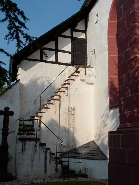
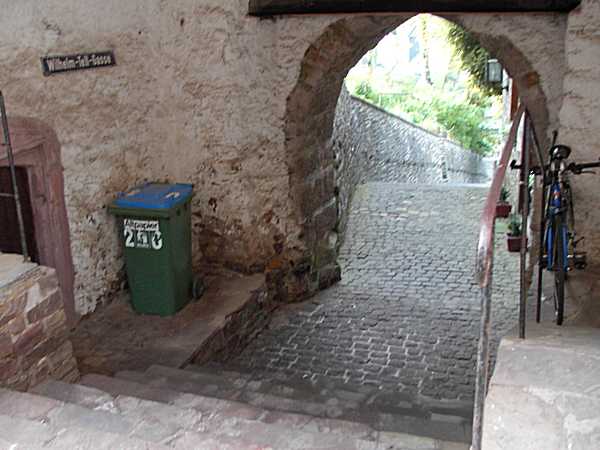
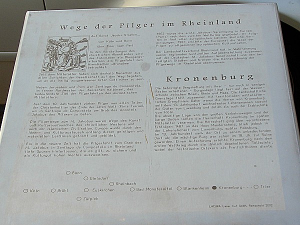
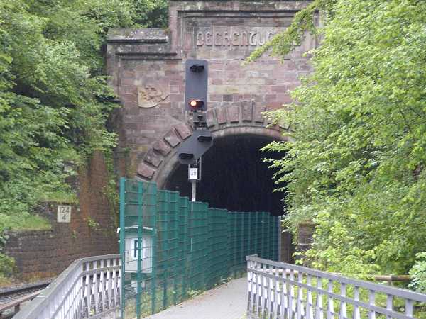
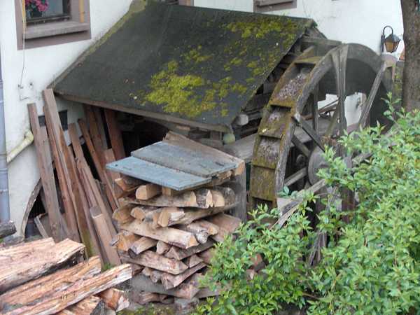
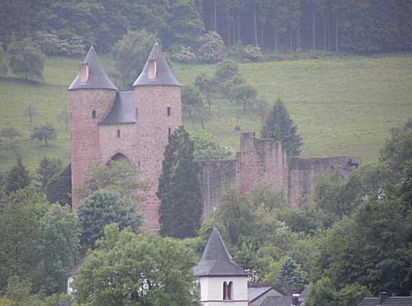
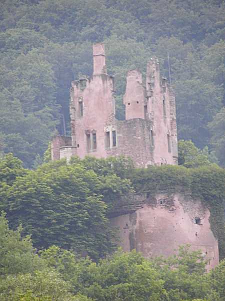
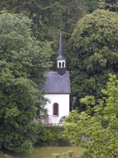
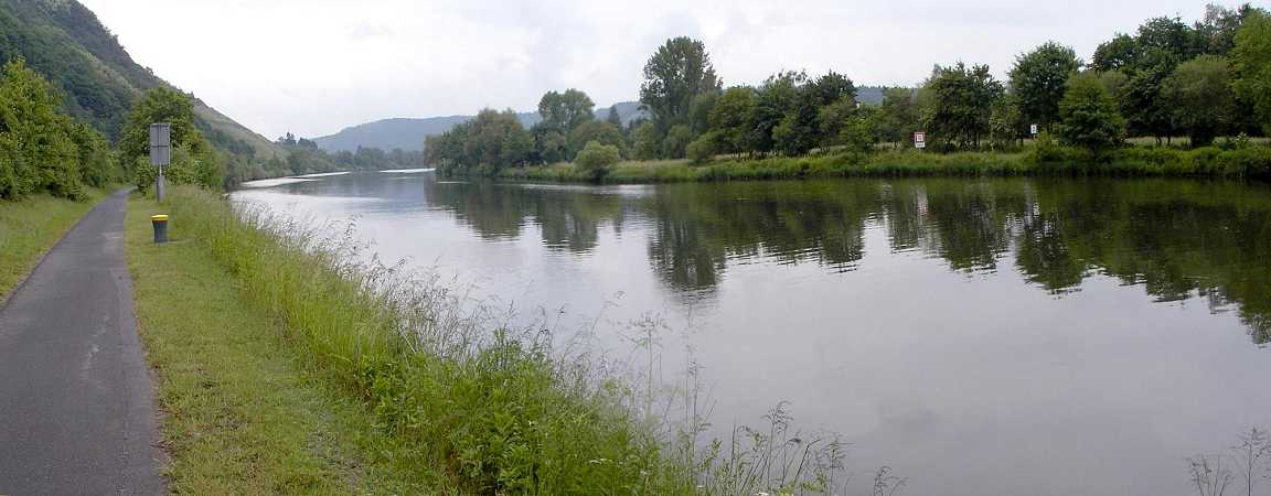
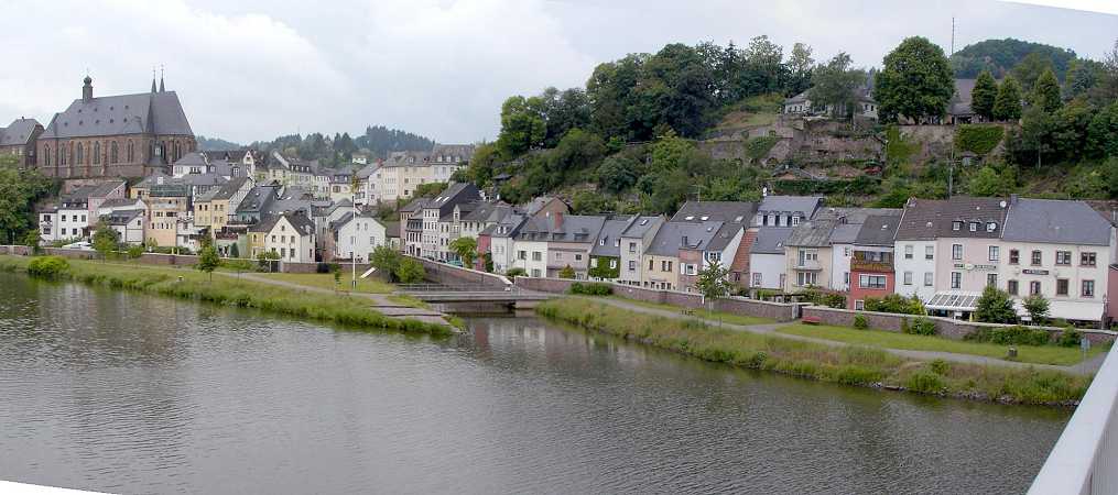
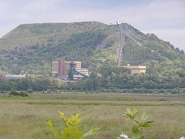
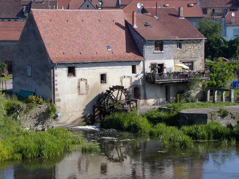
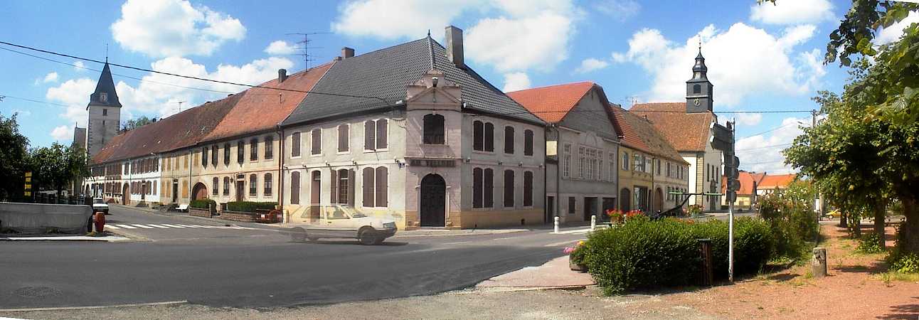
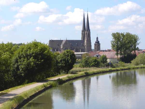
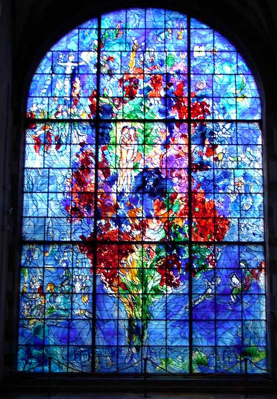
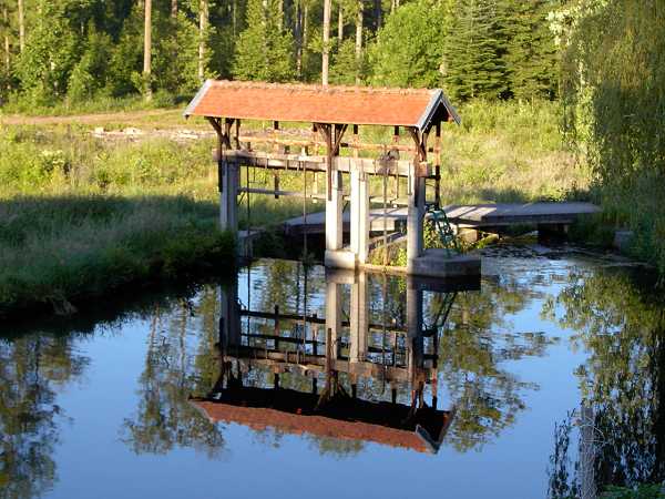
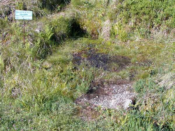
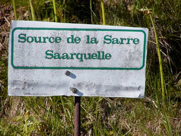
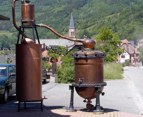
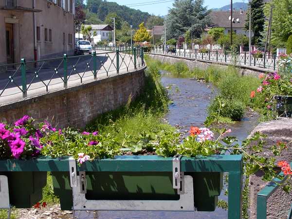
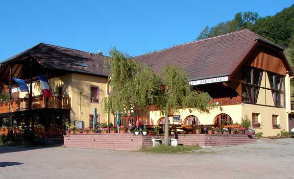
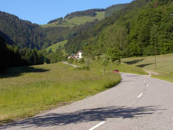
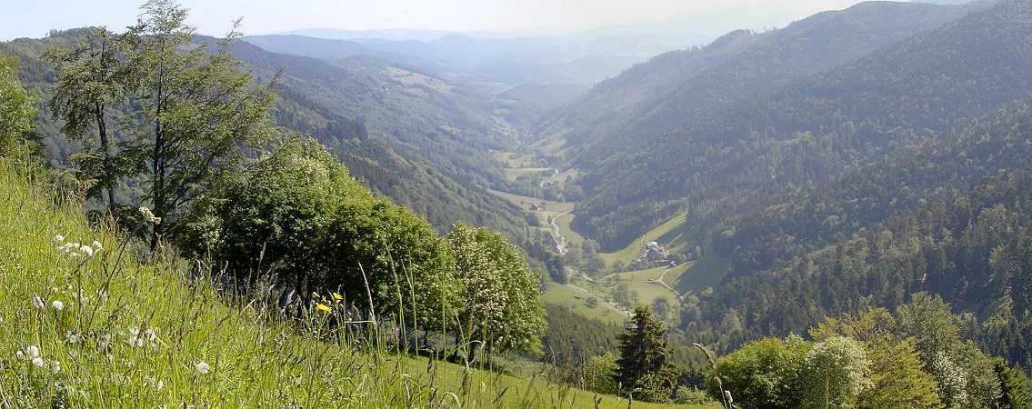
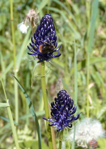
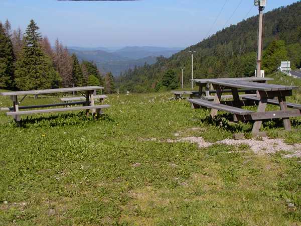
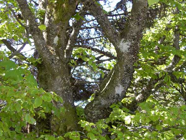
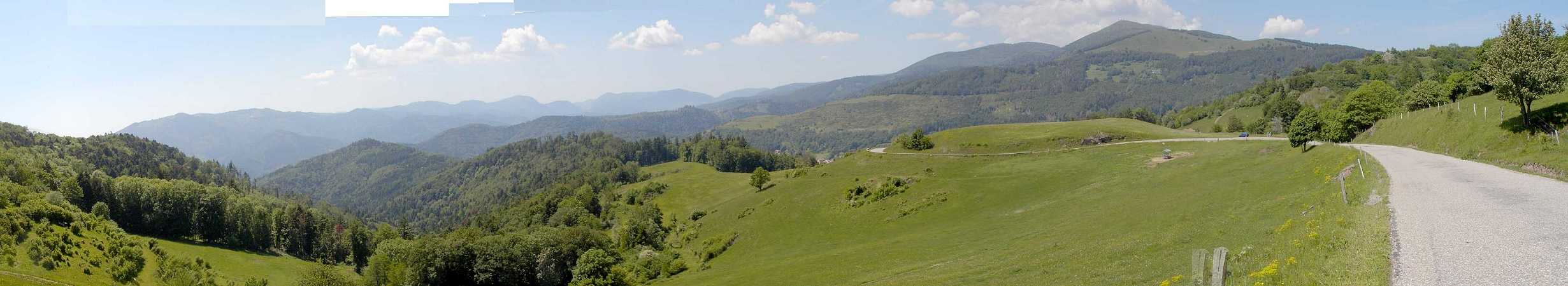
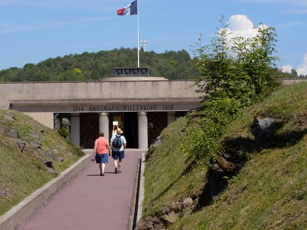
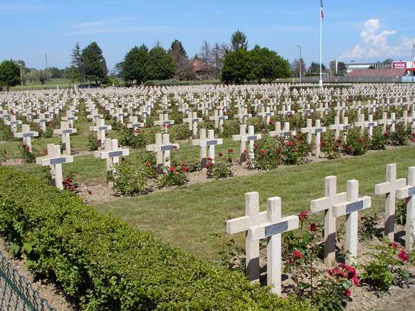
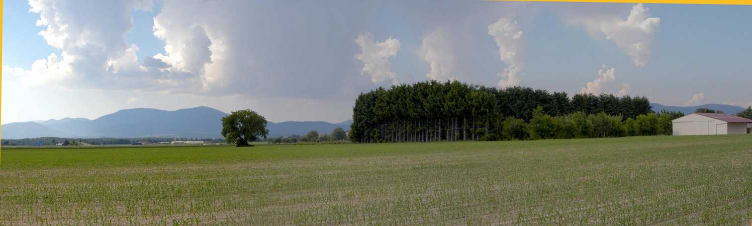
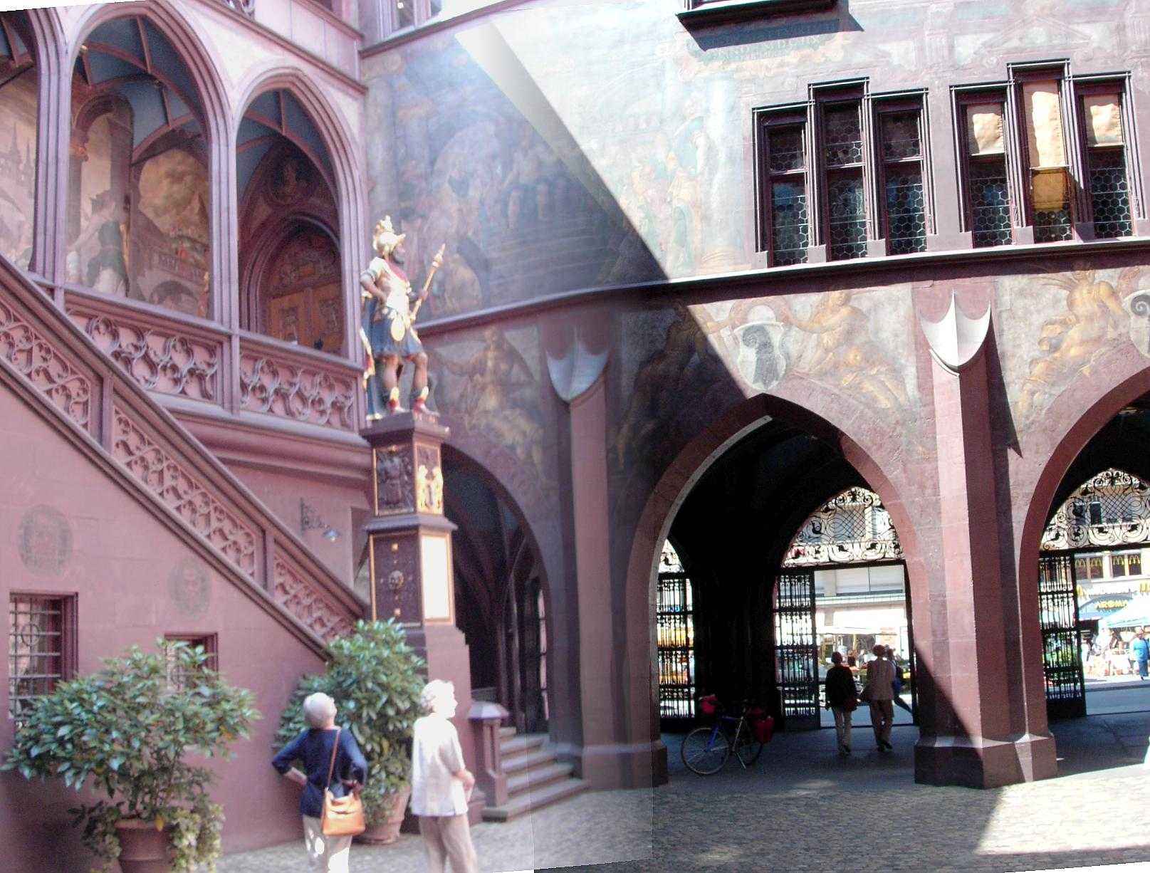
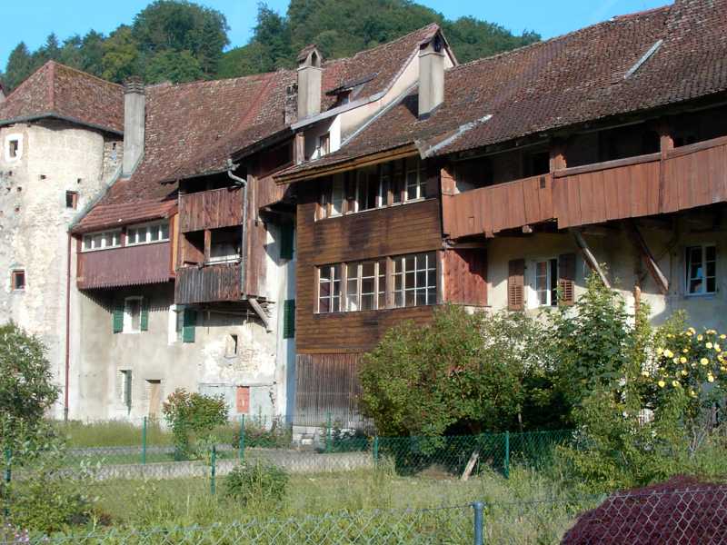
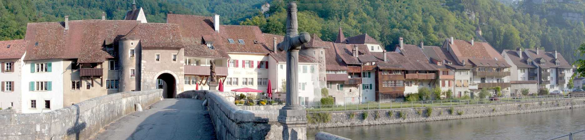
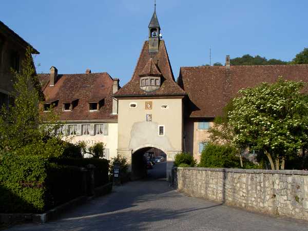
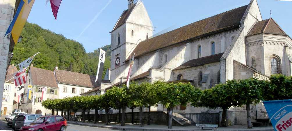
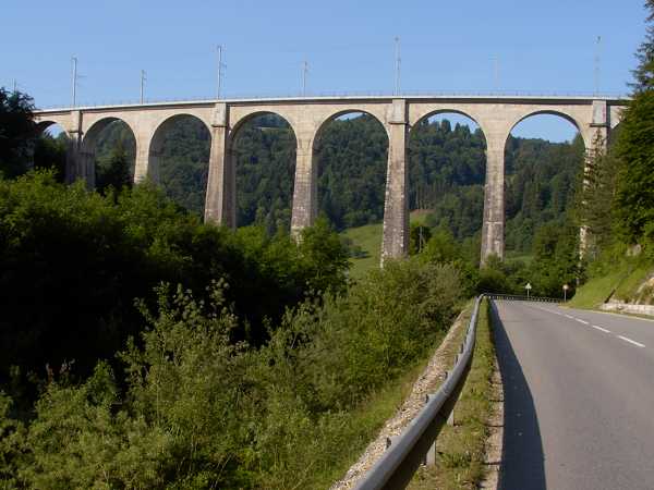
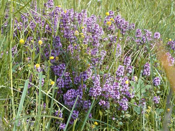
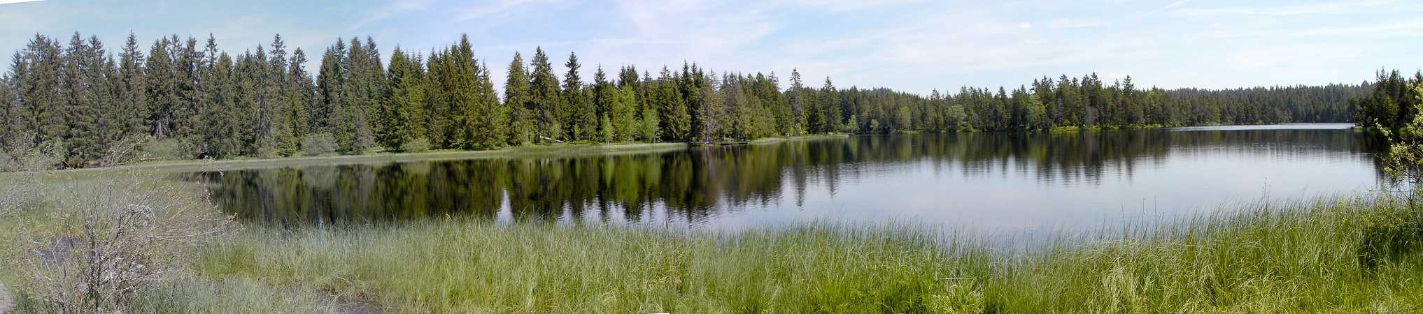
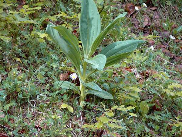
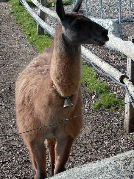
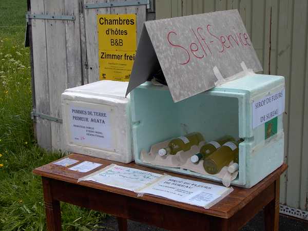
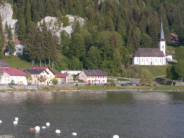
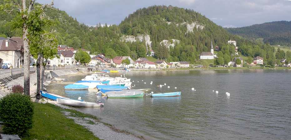
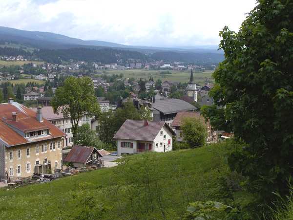
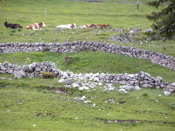
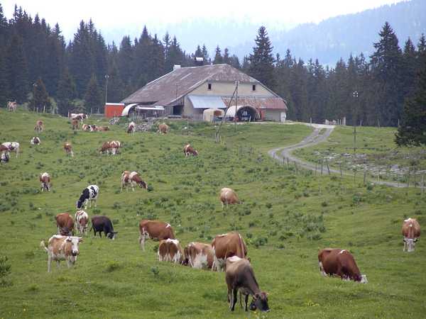
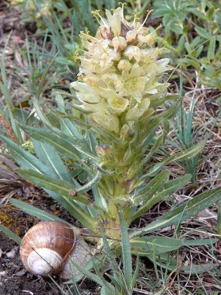
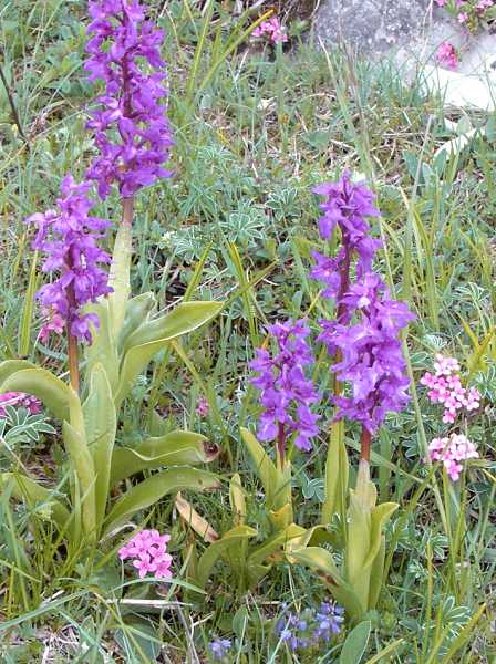
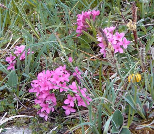
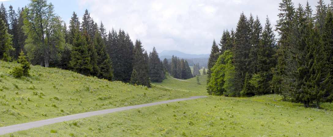
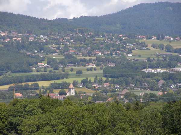
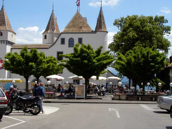
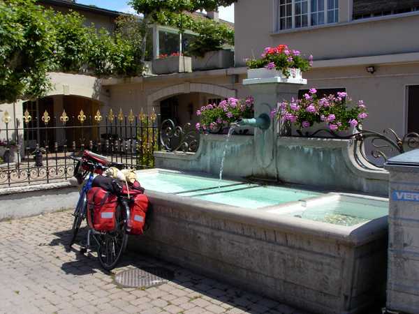
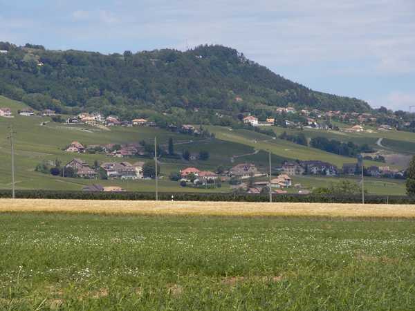
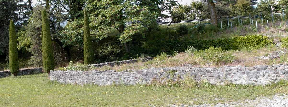
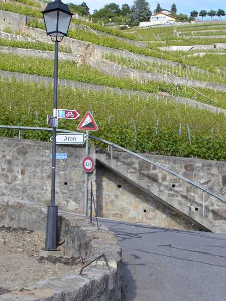
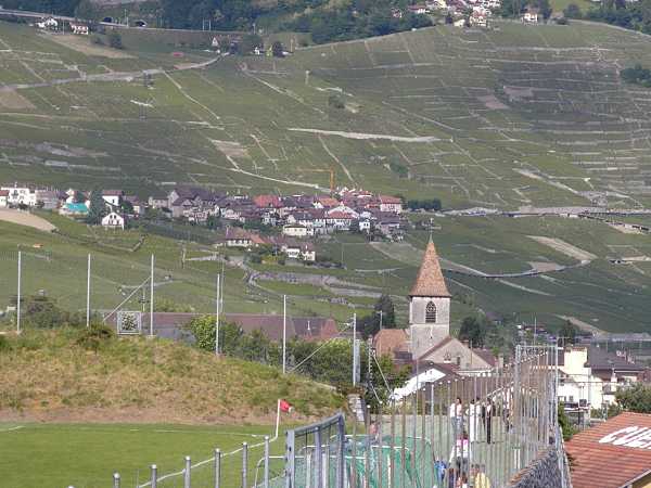
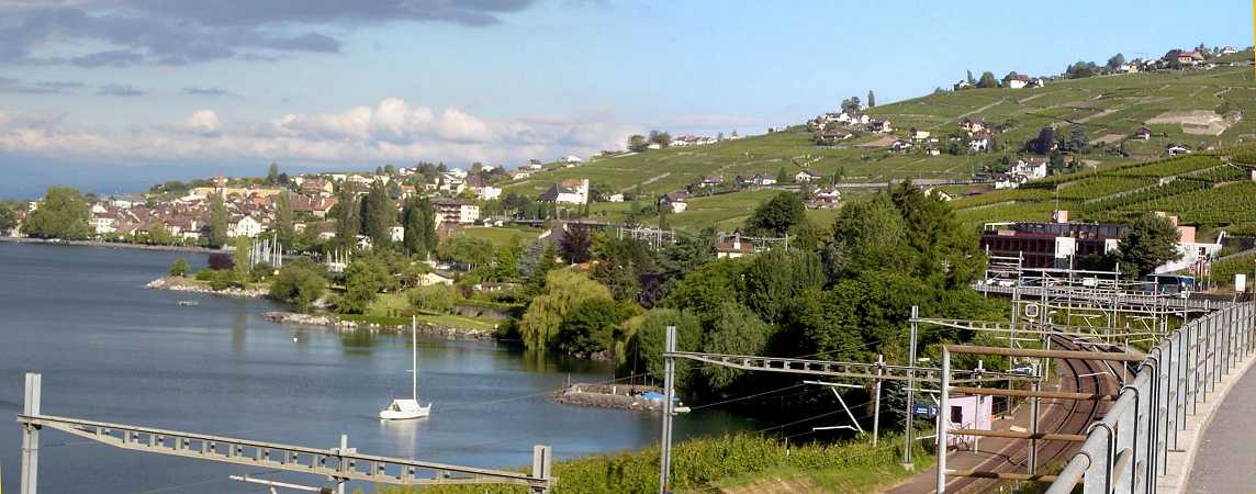
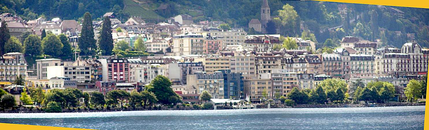
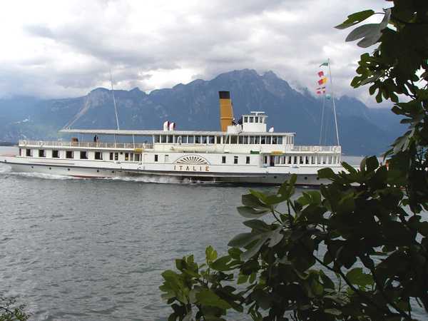
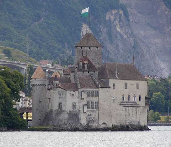
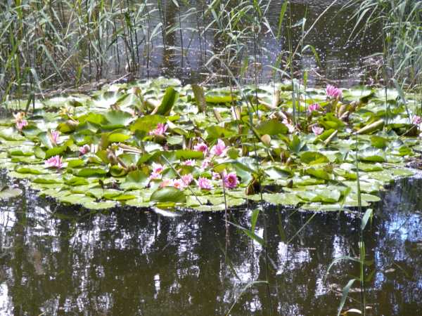
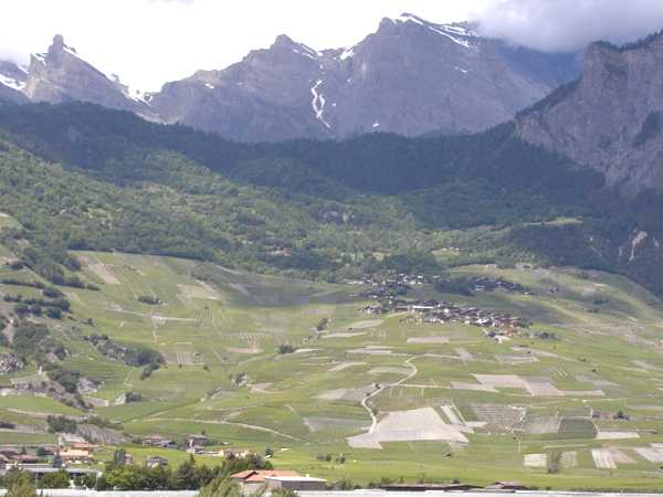
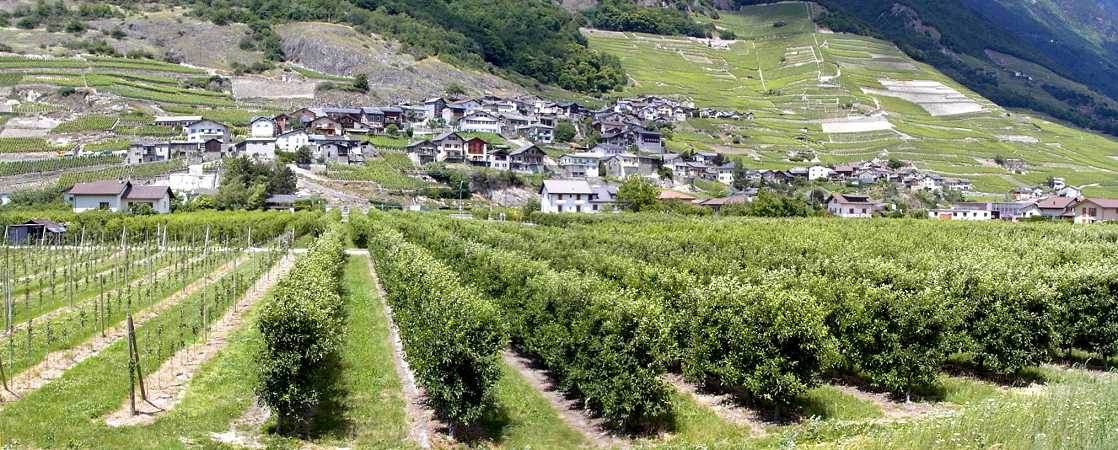
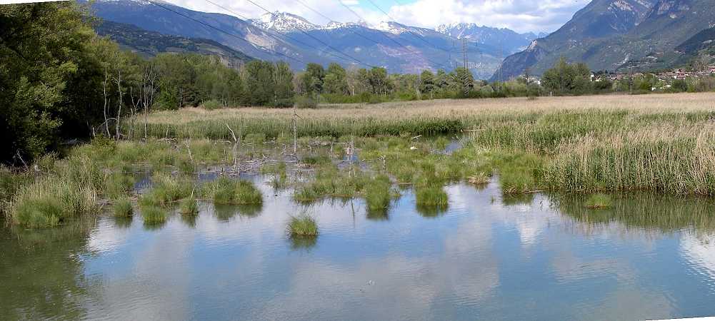
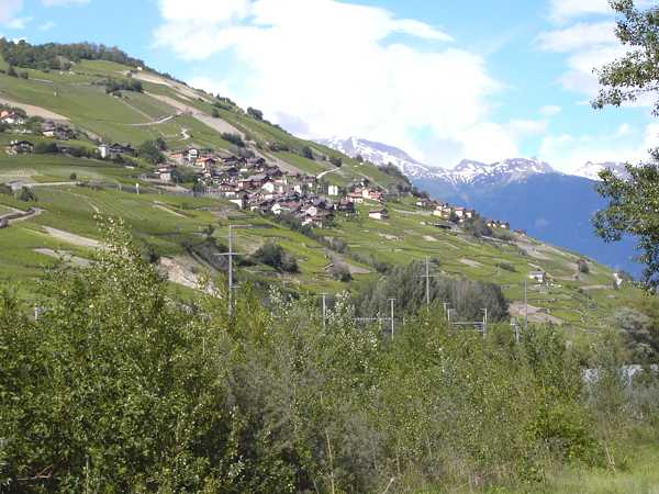
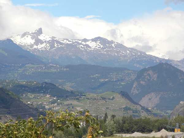
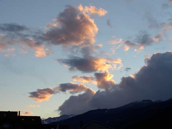
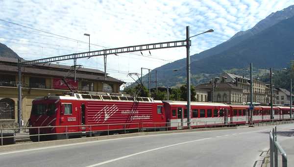
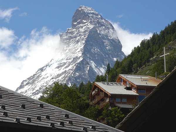
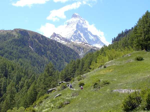
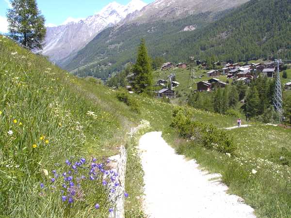
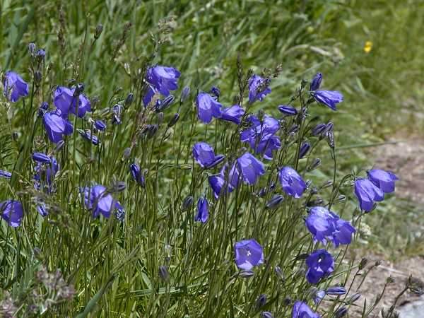
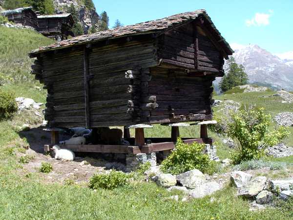
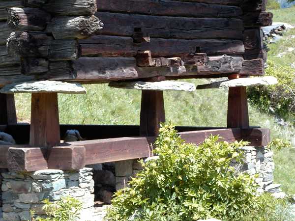
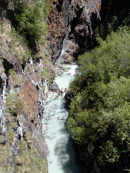
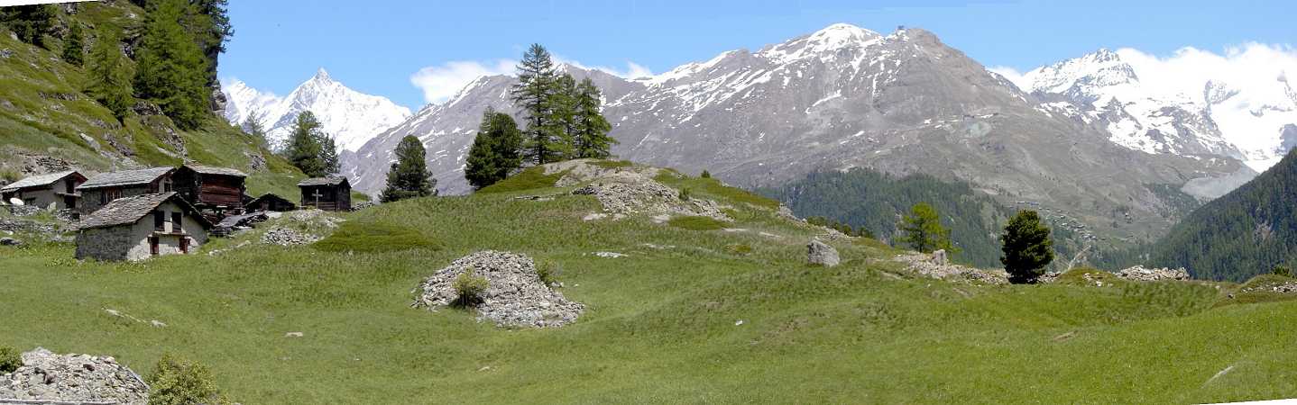
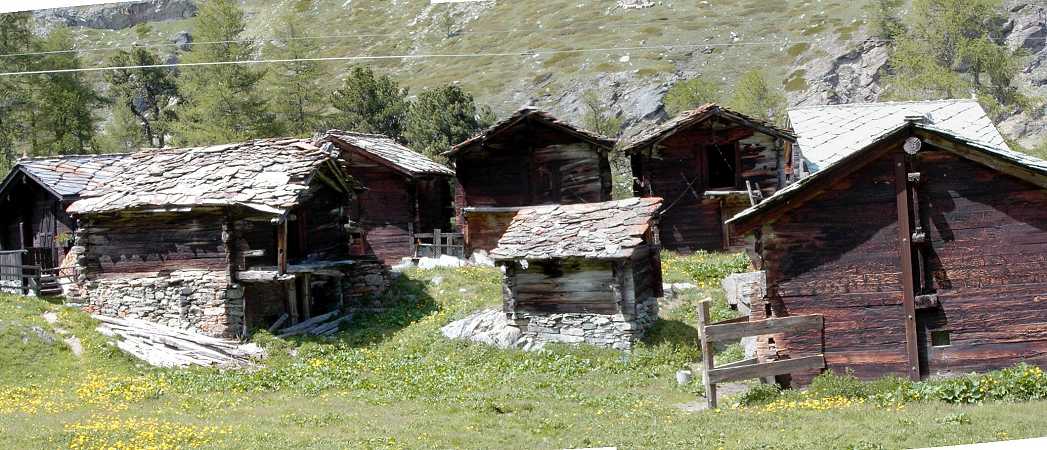
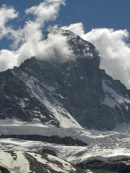
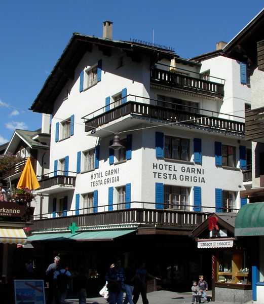
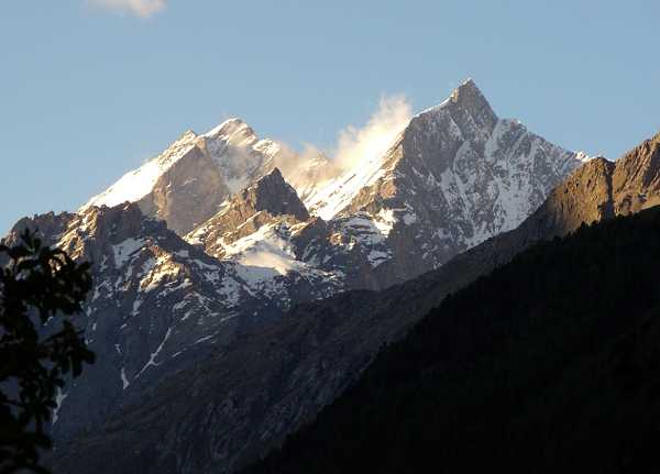
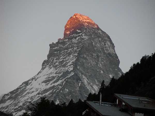
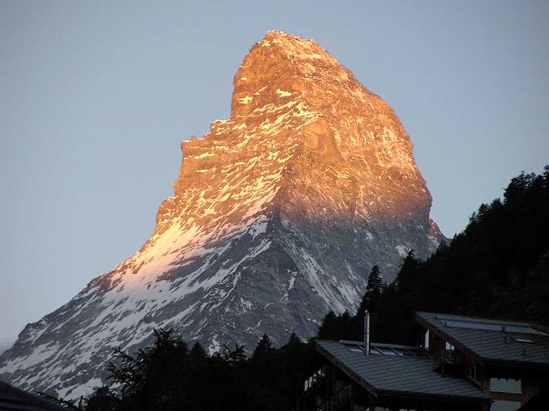
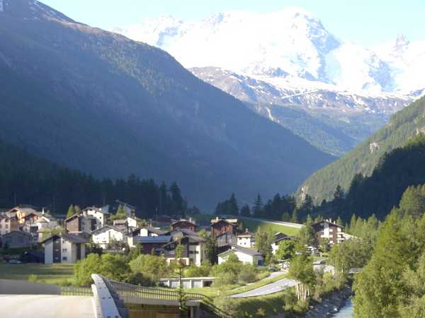
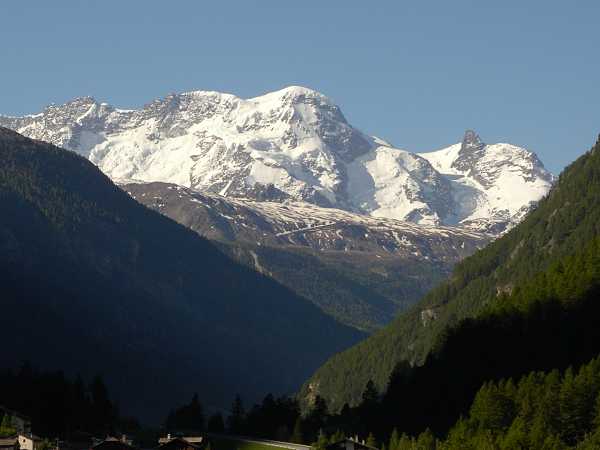
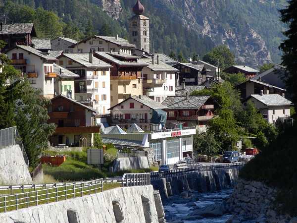
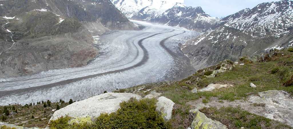
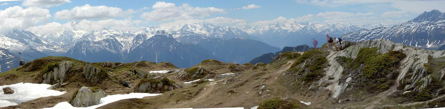
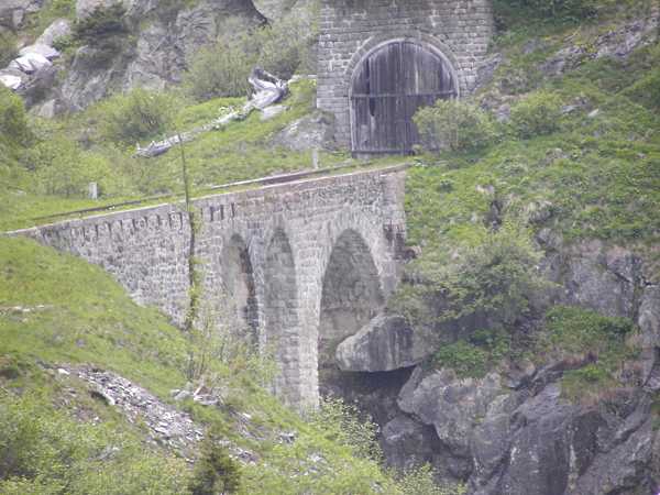
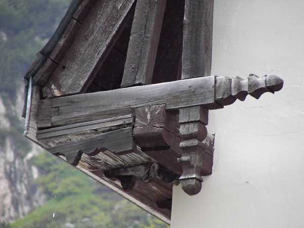
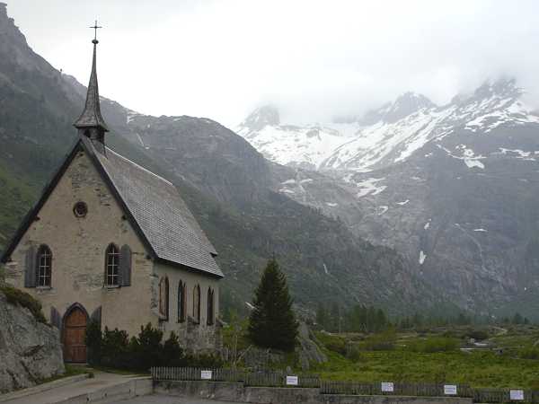
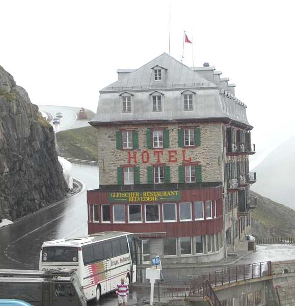
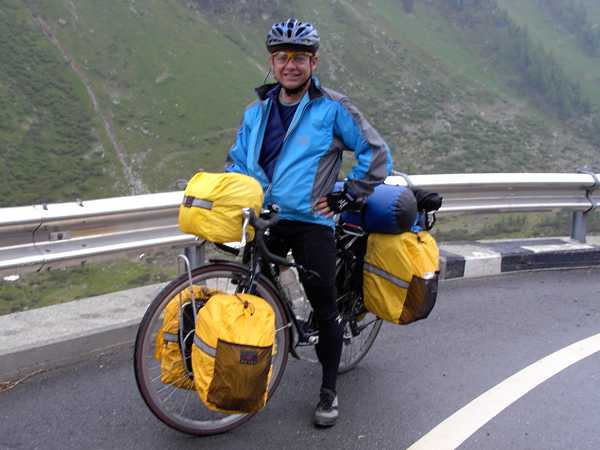
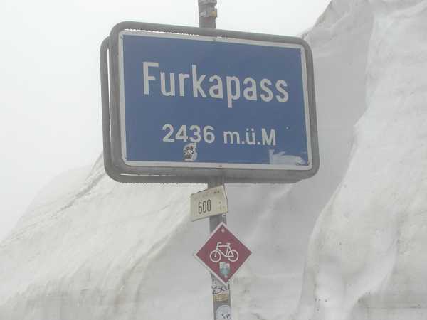
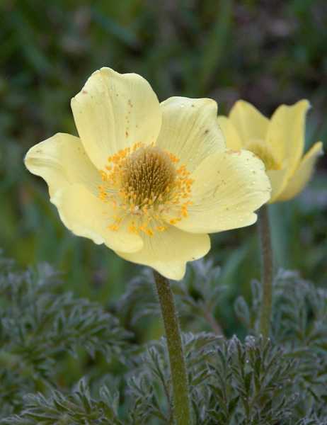
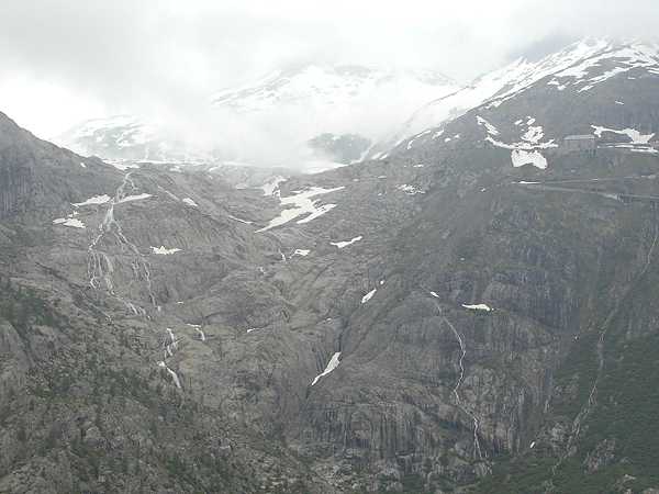
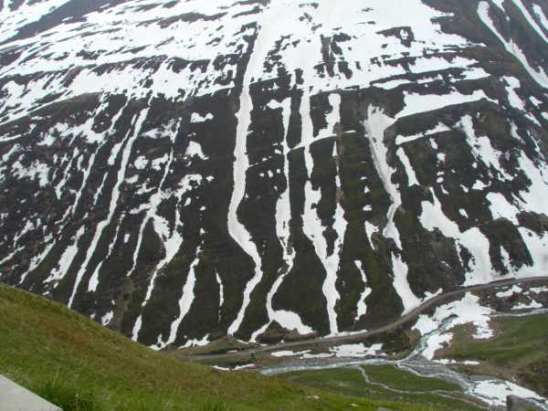
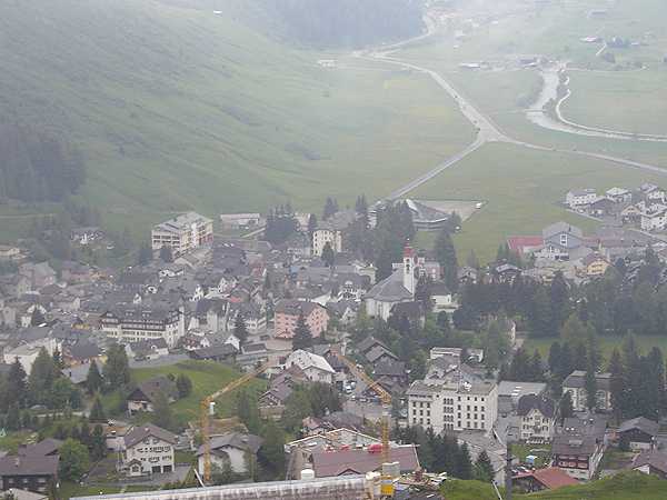
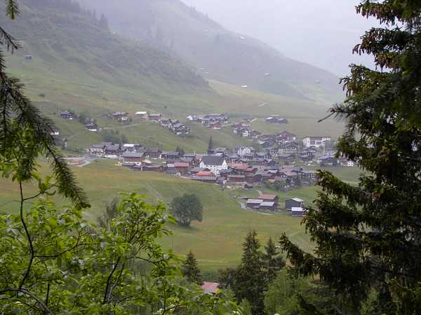
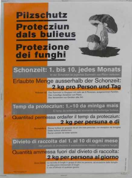
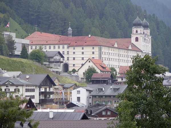
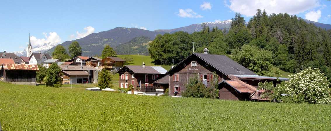
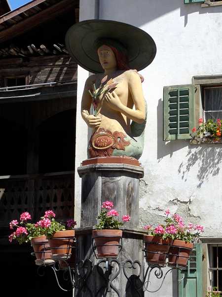
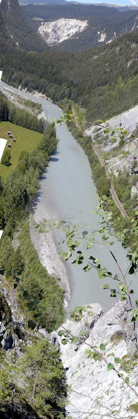
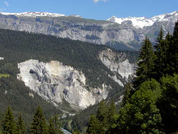
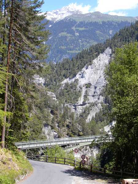
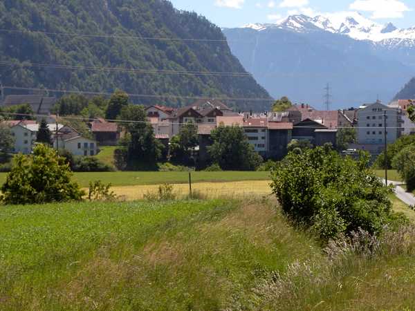
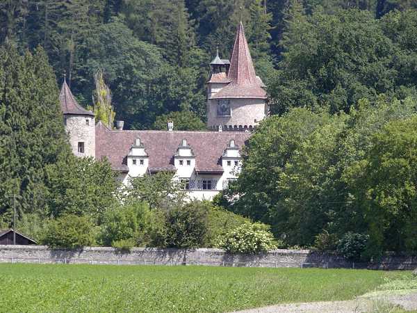
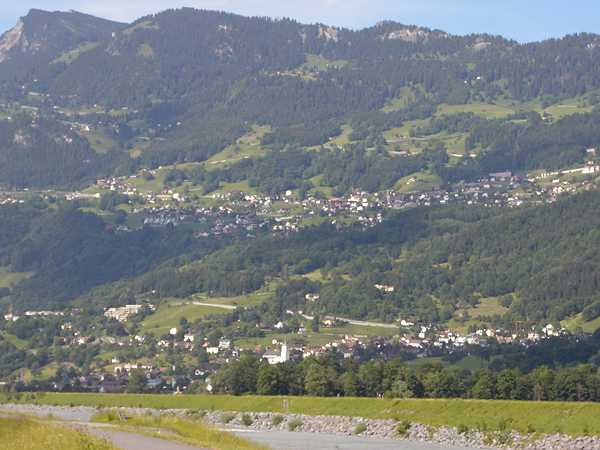
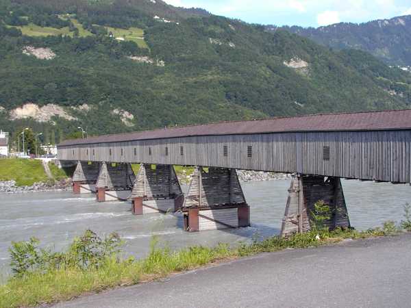
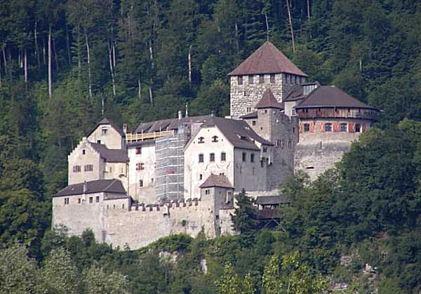
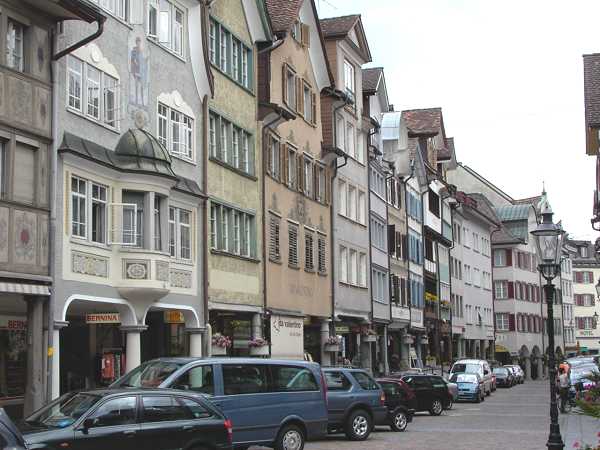
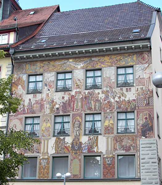
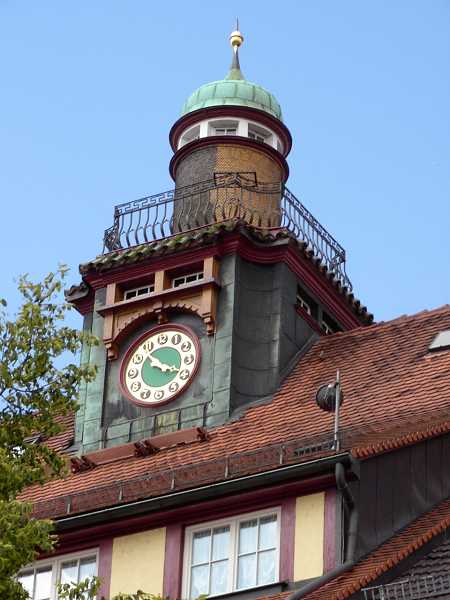
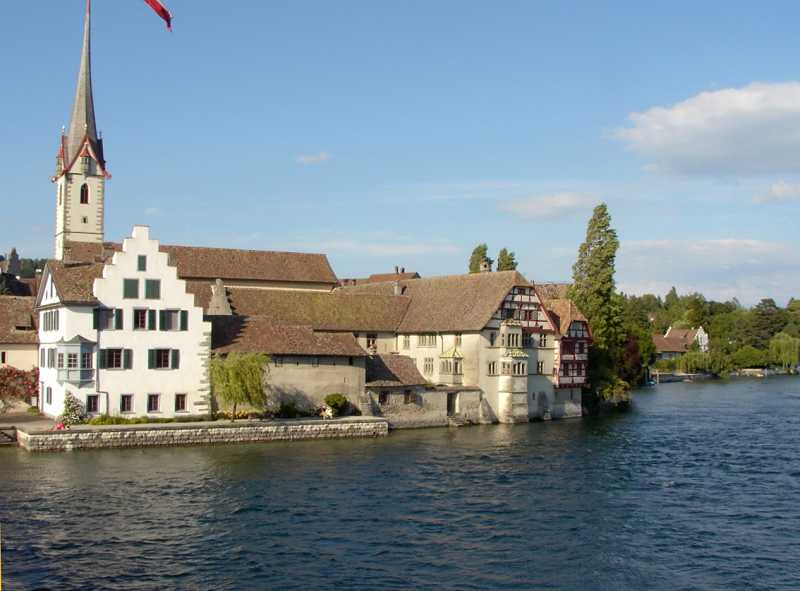
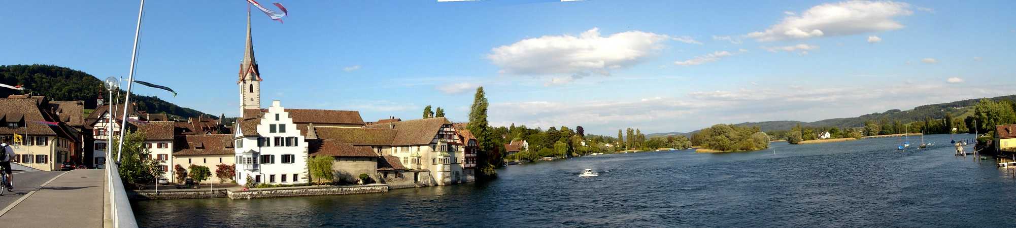
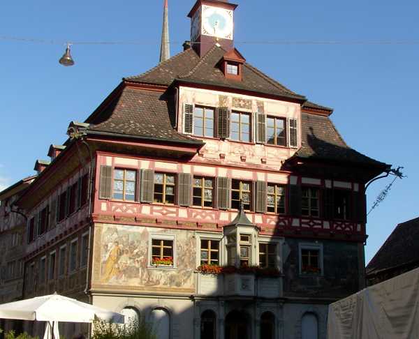
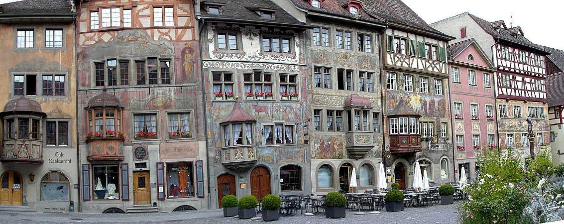
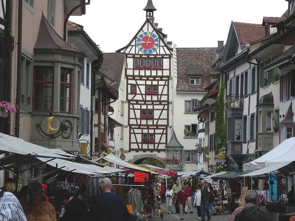
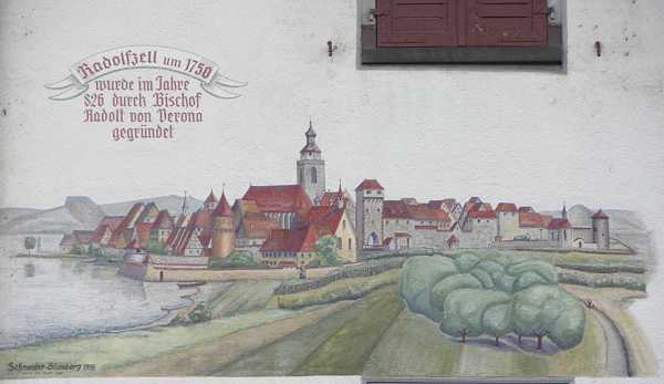
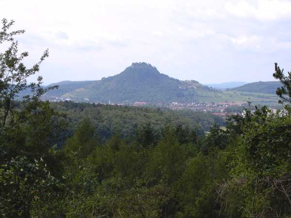
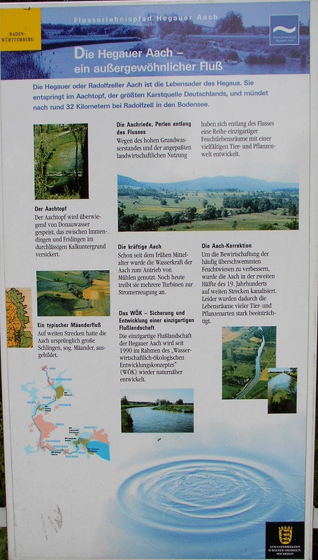
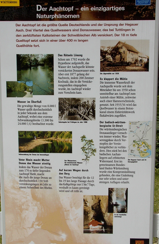
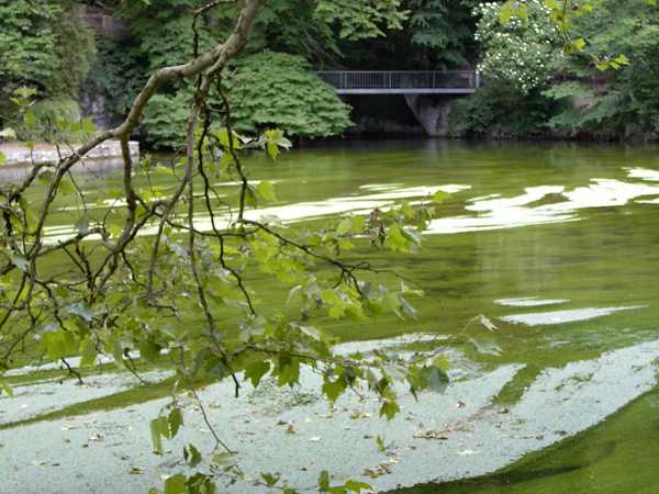
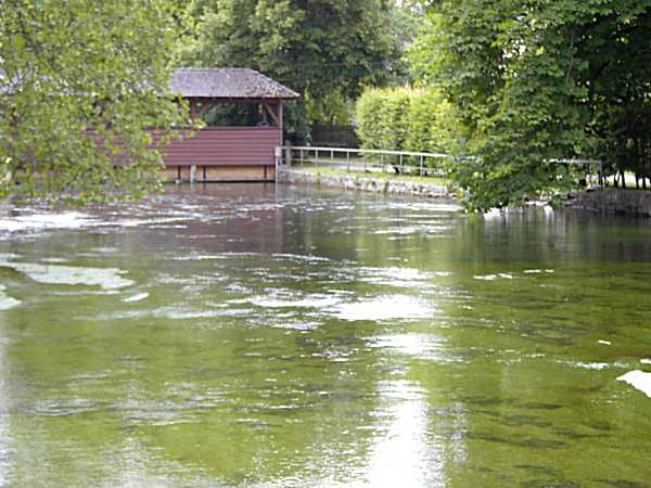
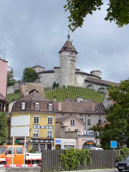
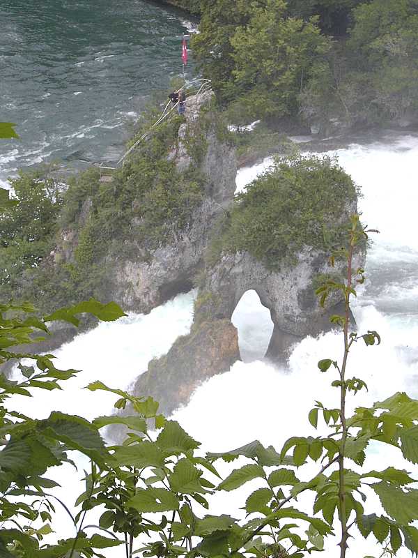
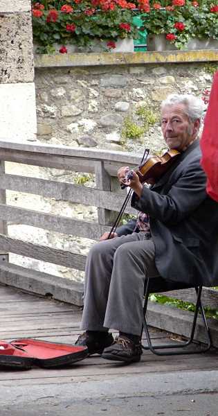
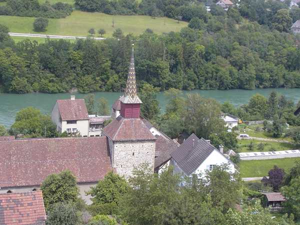
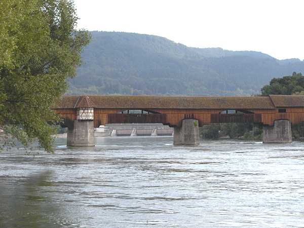
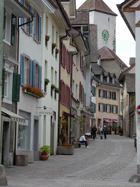
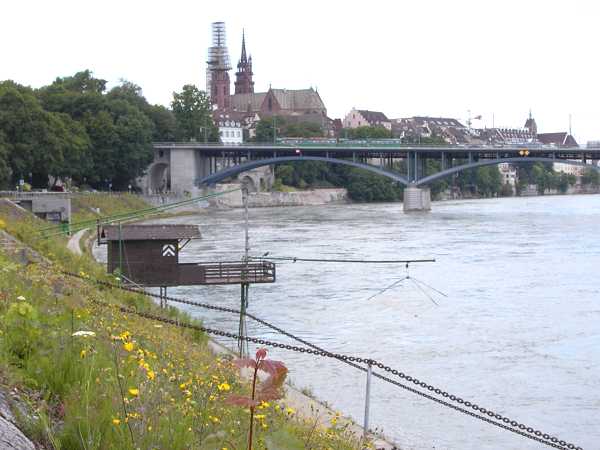
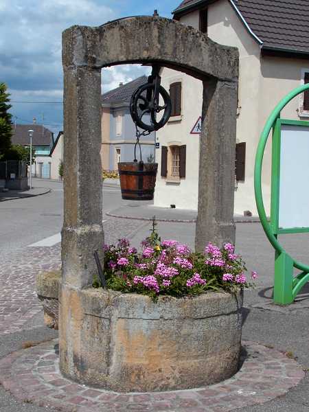
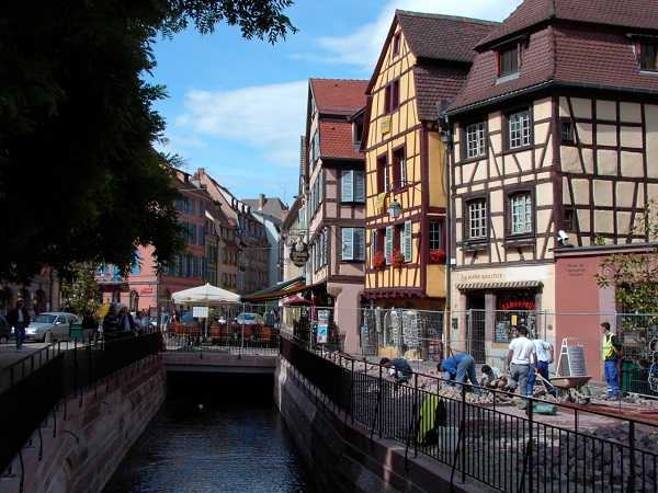
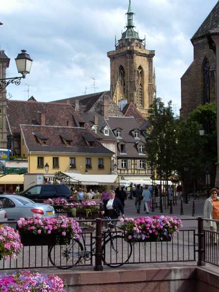
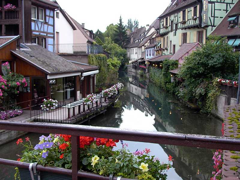
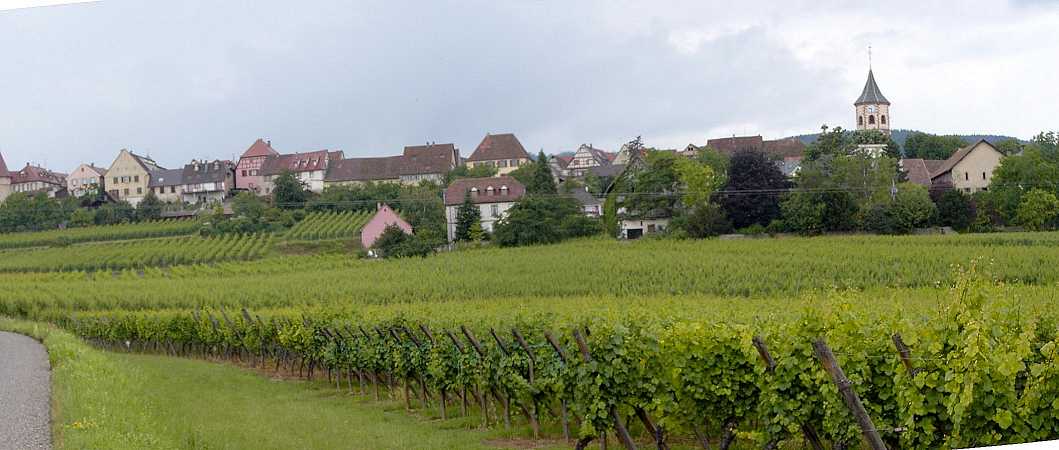
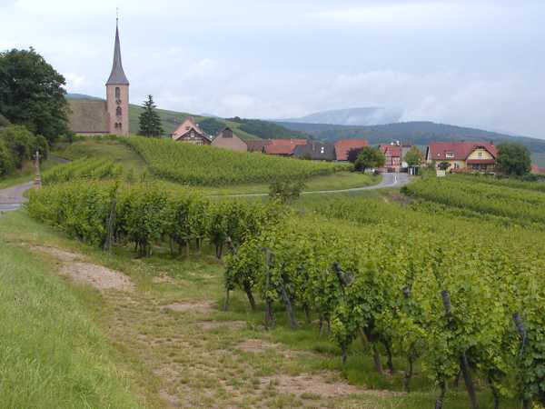
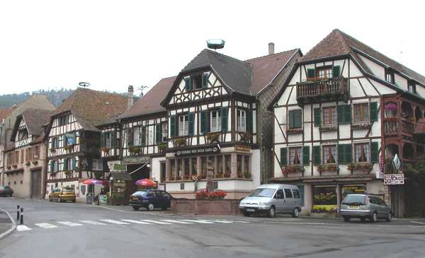
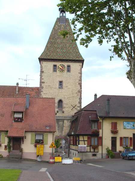
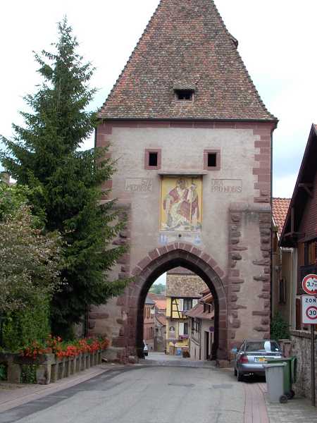
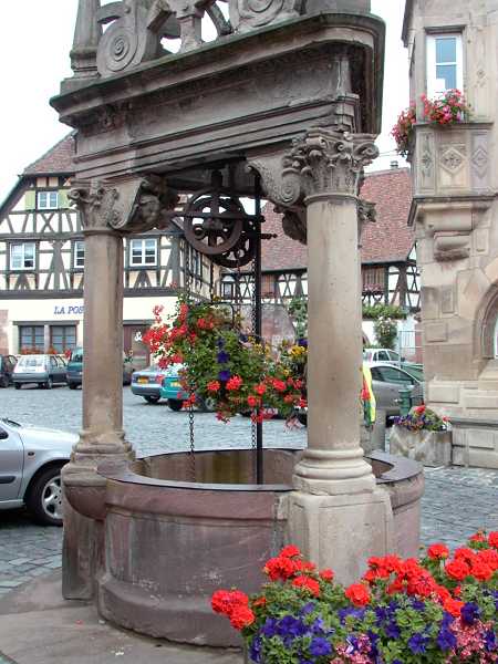
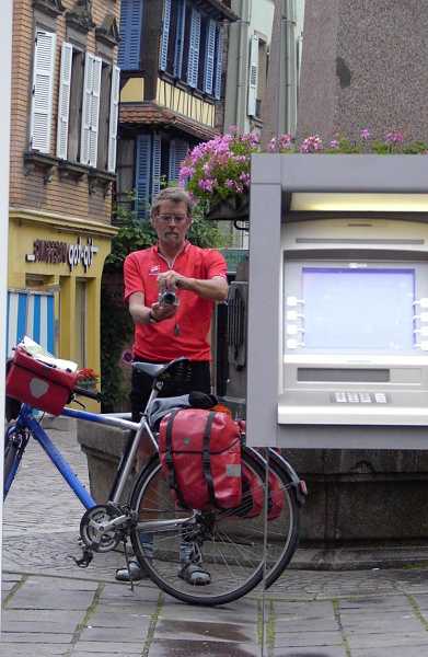
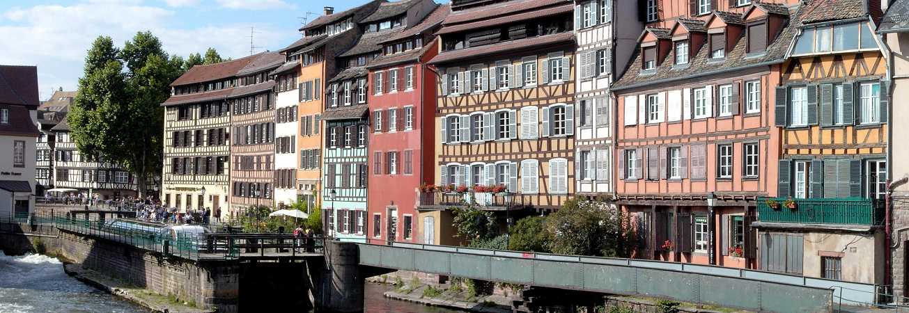
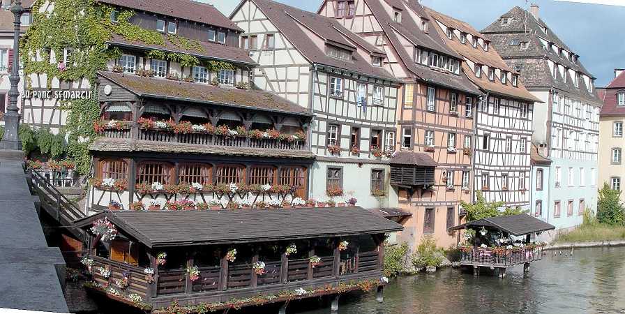
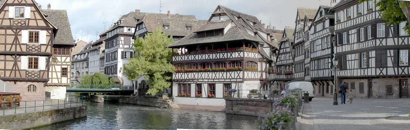
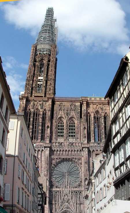
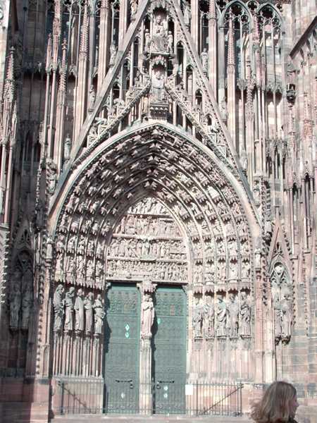